username
X
password
register
for free!
help
show related photosets
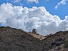
DESTINATION
McDowell Mountains / Tom's Thumb
6 Photosets

2024-09-16  
2021-01-08  
2017-01-02  
2013-03-03  
2010-04-24  
2010-03-17  
mini location map2024-09-16
1 by photographer avatarpseudalpine
photographer avatar
 
McDowell Mountains / Tom's ThumbPhoenix, AZ
Phoenix, AZ
Climbing16.84 Miles 3,897 AEG
Climbing16.84 Miles   5 Hrs   36 Mns   3.17 mph
3,897 ft AEG
 
•• West Corner Solo 4th
Route Scout Route Recorded  on Route Scout | Pop | Map | Popup | MapDEX
No nutrition waist channels were signed into the summit register for 05-May,'18, so the Linked trail guide one did for that day is a lie. It would be fun to research how many more they've embellished. :-s I digress, but at 5:41am the mindless greyhounds all crushed onto the Gateway Loop Trail, so I chose the more mellow Desert Park start. The rat race was avoided because none of them were seen again for the rest of my hike and double T solo. The East End ascent was hot and humid, then some nice breezes and cloud cover helped immensely. I need to remember that the Tom's Thumb TH doesn't have water because two liters was slightly inadequate. :sweat:
 Named place
 Named place [ checklist ]
[ checklist ]  Tom's Thumb
  18 archives
HAZ Member
pseudalpine's
360 Photosets

  2024-09-21
  2024-09-19
  2024-09-16
  2024-09-11
  2024-09-09
  2024-09-08
  2024-09-07
  2024-08-29
  2024-08-25
  2024-08-11
  2024-08-04
  2024-07-20
  2024-07-19
  2024-06-25
  2024-06-18
  2024-06-12
  2024-06-02
  2024-06-01
  2024-05-29
  2024-05-26
1,  2,  3,  4,  5,  6 ... 18  
helpcommentissue

end of page marker