 Route Editor

Devil's chasm access
Moderator: HAZ - Moderators
Linked Area, etc none
-
 laurabalauraGuides: 0 | Official Routes: 0Triplogs Last: 5,008 d | RS: 0Water Reports 1Y: 0 | Last: never
 - Joined: Mar 29 2010 8:47 am
- City, State: phx
Devil's chasm access
Any idea if theres a way to access Devil's chasm from the rim trail above Cherry creek?
contribute to this member driven resource
ie: RS > Save/Share after hikes 

-
 joebartelsGuides: 264 | Official Routes: 224Triplogs Last: 2 d | RS: 2067Water Reports 1Y: 29 | Last: 2 d
 - Joined: Nov 20 1996 12:00 pm
Re: Devil's chasm access
The safest way is a rappel. Check the comments under this http://hikearizona.com/photo.php?ID=222790
- joe
contribute to this member driven resource
ie: RS > Save/Share after hikes
-
laurabalauraGuides: 0 | Official Routes: 0Triplogs Last: 5,008 d | RS: 0Water Reports 1Y: 0 | Last: never
- Joined: Mar 29 2010 8:47 am
- City, State: phx
Re: Devil's chasm access
That's the destination,was really hoping to get back to the rim trail by foot instead of doing some ungodly car shuttle down cherry rd
contribute to this member driven resource
ie: RS > Save/Share after hikes
-
joebartelsGuides: 264 | Official Routes: 224Triplogs Last: 2 d | RS: 2067Water Reports 1Y: 29 | Last: 2 d
- Joined: Nov 20 1996 12:00 pm
Re: Devil's chasm access
Since this posted I chatted with Laura at Squaw Peak and threw out it looked possible to ascend between Pueblo & Cold Spring canyons. By chance in hiking with Karl Faust last weekend he has indeed ascended to the rim out of Pueblo. It's been a long time so he's not sure on specifics. I'm guessing before the hairpin waterfall turn http://hikearizona.com/map.php?QX=4222
Moody & Lucky Strike are nearby trail options too for anyone looking to do a loop.
Moody & Lucky Strike are nearby trail options too for anyone looking to do a loop.
- joe
contribute to this member driven resource
ie: RS > Save/Share after hikes
-
 wallyfrackGuides: 0 | Official Routes: 6Triplogs Last: 3 d | RS: 0Water Reports 1Y: 2 | Last: 187 d
 - Joined: Mar 11 2003 7:33 pm
- City, State: AZ
Re: Devil's chasm access
Joel posted this route up Cold Spring Canyon. It may not be easy. 
http://hikearizona.com/map.php?GPS=10047
http://hikearizona.com/map.php?GPS=10047
contribute to this member driven resource
ie: RS > Save/Share after hikes
-
 FOTGGuides: 37 | Official Routes: 103Triplogs Last: 11 d | RS: 204Water Reports 1Y: 70 | Last: 3 d
 - Joined: Jan 21 2013 10:47 am
- City, State: AZ
- Contact:
Re: Devil's chasm access
@joe bartels
@wallyfrack
I am down to recon both routes, if anyone is interested..something tells me cliffing out is probably the least of one's worries, I bet that manzinita, holly oak and the rest of the gang gets down right diabolical through there...
@wallyfrack
I am down to recon both routes, if anyone is interested..something tells me cliffing out is probably the least of one's worries, I bet that manzinita, holly oak and the rest of the gang gets down right diabolical through there...
contribute to this member driven resource
ie: RS > Save/Share after hikes
-
 big_loadGuides: 0 | Official Routes: 1Triplogs Last: 515 d | RS: 3Water Reports 1Y: 0 | Last: 2,718 d
 - Joined: Oct 28 2003 11:20 am
- City, State: Andover, NJ
Re: Devil's chasm access
Vegetative obstruction aside, I've always thought there must be a route.
contribute to this member driven resource
ie: RS > Save/Share after hikes
-
joebartelsGuides: 264 | Official Routes: 224Triplogs Last: 2 d | RS: 2067Water Reports 1Y: 29 | Last: 2 d
- Joined: Nov 20 1996 12:00 pm
Re: Devil's chasm access
Based on the route notes between Joel & Steve he cliffed out. I posted it earlier and deleted it myself 
- joe
contribute to this member driven resource
ie: RS > Save/Share after hikes
-
 sneakySASQUATCHGuides: 4 | Official Routes: 6Triplogs Last: 283 d | RS: 2Water Reports 1Y: 0 | Last: 2,401 d
 - Joined: Aug 23 2005 9:26 am
- City, State: Pike National Forest, Co
Re: Devil's chasm access
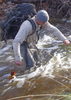
I am 95% sure that you can go through cold springs canyon to the rim. I have hiked all the way to the waterfall and there were a couple spots where you can climb out to higher ledges. Also while hiking looking for and finding v:174
http://hikearizona.com/photoset.php?ID=17488&start=0
I followed the canyon up on a ledge past the v:136 up to v:174. It sucked, but those ruins are high enough that it was not feasible for them to go down to get to water or farm. I'm pretty sure they either followed the ledge where the ruins are located around and climbed up a prominent ravine or down climbed to the ledge I followed and then headed toward the head wall and climbed up the same ravine. I never got a chance to go back and do cold spring from bottom to top or vice versa. Those of you that have done v:164 with me or found it know what ravine and access I'm talking about. V:174 is much closer to 164 than 136 and I would bet they farmed on the rim not down by Cherry Creek.
For climbing or down climbing access you need enough rope for this.
http://hikearizona.com/photo.php?ZIP=177510
Have fun!
I may have some tracks at home if a group of you decide to attempt this. Pm me.
contribute to this member driven resource
ie: RS > Save/Share after hikes
-
sneakySASQUATCHGuides: 4 | Official Routes: 6Triplogs Last: 283 d | RS: 2Water Reports 1Y: 0 | Last: 2,401 d
- Joined: Aug 23 2005 9:26 am
- City, State: Pike National Forest, Co
Re: Devil's chasm access
@friendofThundergod
The canyon bottom is just rock hopping for the entire way. The ledge beyond v:136 and the Ruins around the corner has got some pretty good exposure and tons of sharp prickly things. If I recall I ruined a shirt and pair of pants on the hike to v:174.
@joe bartels
I did cliff out at the waterfall, but on a previous attempt with fly phi we didn't make it to the head wall and instead climbed up a couple of spots where you can get out of the bottom of the canyon. I think you can work your way up to the level that I traversed to v:174 from the bottom which is probably 300' from the canyon floor. When we went in the winter it was too slick to climb those same spots.
http://hikearizona.com/photo.php?ZIP=166088
This is one of the washes we came up from the floor.
contribute to this member driven resource
ie: RS > Save/Share after hikes
-
 GrasshopperGuides: 48 | Official Routes: 143Triplogs Last: 322 d | RS: 0Water Reports 1Y: 0 | Last: 1,047 d
 - Joined: Dec 28 2006 5:06 pm
- City, State: Scottsdale, AZ
Re: Devil's chasm access
@MtnBart01
WTG..Let's keep all this on the
 ..talk in code and post all details against a different forum canyon topic
WTG..Let's keep all this on the
(Outside.. "there is No Place Like It!!")
contribute to this member driven resource
ie: RS > Save/Share after hikes
-
 RedRoxx44Guides: 5 | Official Routes: 0Triplogs Last: 3 d | RS: 0Water Reports 1Y: 0 | Last: 6,527 d
 - Joined: Feb 15 2003 8:07 am
- City, State: outside, anywhere
Re: Devil's chasm access
Many years ago I hiked past Cold Spring on what appeared to be an old road/trail toward Devils'--- it looked doable but super brushy to get up at least a cliff band or two but I could not see clearly to the top and that's usually what gets one in trouble.
contribute to this member driven resource
ie: RS > Save/Share after hikes
-
laurabalauraGuides: 0 | Official Routes: 0Triplogs Last: 5,008 d | RS: 0Water Reports 1Y: 0 | Last: never
- Joined: Mar 29 2010 8:47 am
- City, State: phx
Re: Devil's chasm access
Thank you all for all the great hints,routes and advice.Looks like November might be the best month to go with the leaves turning.Also Pueblo canyon might be a better choice than Cold springs,but i imagine will be a shredding fest either way
contribute to this member driven resource
ie: RS > Save/Share after hikes