 Route Editor

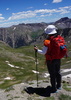
The Coconino National Forest proposes to expand mass transit shuttle services at select trailheads located within the greater Sedona area to reduce traffic congestion, overflow parking in residential areas, and improve pedestrian safety.
Traffic and congested parking during peak visitation are frequent complaints by Sedona residents and visitors. Popular trailheads are often beyond parking capacity. Parking demand then displaces visitors more than a half-mile away into undesignated areas, surrounding neighborhoods, and surface streets. This traffic pattern results in resource damage, adverse public safety, and diminished quality of life for residents.
Access to popular trailheads can be improved by utilizing alternative modes of transportation for visitors who would otherwise drive their own vehicles to trailheads. A proposed transit program, operated by the City of Sedona, would offer reliable transportation to and from popular trailheads.
“I believe this joint venture between the Red Rock Ranger District and the City of Sedona will help mitigate some of the traffic congestion problems people face at trailheads and also improve safety for pedestrians across the board,” said District Ranger Amy Tinderholt. “With how popular these trails have become, it will be vital to find long-term solutions such as this to allow for greater and safer access, while improving the experience for everyone in the area.”
A description of the proposed action, along with maps and other information, can be found at www.fs.usda.gov/project/?project=60969 (pdf is attached below).
Key points of the transit proposal include:
Five trailheads would incorporate shuttle services: Dry Creek, Little Horse, Mescal, Cathedral Rock, and Soldiers Pass.
Proposed transit operations would occur 8 a.m. to 6:30 p.m. Thursday through Sunday, beginning March 2022, and offered year-round.
Shuttles would operate on an approximate 15- to 45-minute frequency.
Public parking would remain open at Dry Creek, Little Horse, and Mescal trailheads.
Cathedral Rock and Soldiers Pass trailheads would be closed to public parking during shuttle operations to encourage the use of the shuttle and alternative transportation.
Pedestrian and bicycle traffic is encouraged as an alternative transportation method.
Shuttles may be increased during peak-use holidays and spring break months.
To accommodate shuttle access at Cathedral Rock, a trailhead re-design would convert an existing pedestrian path to a motorized route that exits onto Back O’ Beyond Road. A new pedestrian path would be constructed.
Trailhead modifications may include adding a designated shuttle stop, relocating parking stalls, or closing select parking stalls during shuttle operations.
HOW TO COMMENT
The public is invited to provide input on the Red Rock Country Trailhead Transit and Parking Restrictions Project during a 30-day comment period from Oct. 20 to Nov. 19, 2021.
Please provide written comments with “Trailhead Transit” in the subject line via:
E-mail: comments-southwestern-coconino-redrock@usda.gov; or
Fax: (928) 203-7539; or
Regular mail: Red Rock Ranger District, Attention: Trailhead Transit, P.O. Box 20429, Sedona, AZ 86431; or
Hand-delivered: Red Rock District Office at 8375 State Route 179, Sedona, AZ 86351 between the hours of 9 a.m. – 4 p.m. weekdays.
Coconino NF proposes trailhead transit expansion
Moderator: HAZ - Moderators
Linked Guides none
Linked Area, etc none
-
 joebartelsGuides: 264 | Official Routes: 224Triplogs Last: 5 d | RS: 2066Water Reports 1Y: 28 | Last: 18 d
 - Joined: Nov 20 1996 12:00 pm
Coconino NF proposes trailhead transit expansion
SEDONA, Ariz., Oct. 20, 2021
- joe
contribute to this member driven resource
ie: RS > Save/Share after hikes 

-
 chumleyGuides: 94 | Official Routes: 239Triplogs Last: 10 d | RS: 73Water Reports 1Y: 92 | Last: 9 d
 - Joined: Sep 18 2002 8:59 am
- City, State: Tempe, AZ
Re: Coconino NF proposes trailhead transit expansion
@hikeaz That one is a bit ahead of my time. But makes sense because 1555 years before that apparently we will be living under water.
[ youtube video ]
[ youtube video ]
I'm not sure what my spirit animal is, but I'm confident it has rabies.
contribute to this member driven resource
ie: RS > Save/Share after hikes
-
 xthineGuides: 0 | Official Routes: 0Triplogs Last: 1,480 d | RS: 0Water Reports 1Y: 0 | Last: never
 - Joined: Jul 22 2016 10:20 pm
- City, State: Sedona, AZ
- Contact:
Re: Coconino NF proposes trailhead transit expansion
Apparently non service dogs are allowed only if they can fit in a pet carrier and can be stored out the the doorway and aisle.
contribute to this member driven resource
ie: RS > Save/Share after hikes
-
 hikeazGuides: 6 | Official Routes: 0Triplogs Last: 1,244 d | RS: 0Water Reports 1Y: 0 | Last: 1,244 d
 - Joined: May 13 2002 10:07 am
- City, State: Tempe, AZ
- Contact:
Re: Coconino NF proposes trailhead transit expansion
Shuttles and trailhead closures starting March 24th! (BTW - masks required through 4/18/22 (at least))
The logic-masters at work > SEDONA, Ariz., March 11, 2022 – The upper portion of Cathedral Rock Trail will temporarily close to the public for construction starting March 16. The closure will remain in place through April 30, but could lift earlier if construction work ends sooner.
The logic-masters at work > SEDONA, Ariz., March 11, 2022 – The upper portion of Cathedral Rock Trail will temporarily close to the public for construction starting March 16. The closure will remain in place through April 30, but could lift earlier if construction work ends sooner.
"The censorship method ... is that of handing the job over to some frail and erring mortal man, and making him omnipotent on the assumption that his official status will make him infallible and omniscient."
George Bernard Shaw
George Bernard Shaw
contribute to this member driven resource
ie: RS > Save/Share after hikes
-
 JimGuides: 76 | Official Routes: 39Triplogs Last: 4 d | RS: 94Water Reports 1Y: 7 | Last: 4 d
 - Joined: Sep 08 2006 8:14 pm
Re: Coconino NF proposes trailhead transit expansion
I either forgot about this or never noticed until today when I saw a MGS video and noticed the trailhead was closed in the day. Not cool!
https://sedonashuttle.com/how-to-ride/#HolidaySchedule
https://sedonashuttle.com/wp-content/up ... h-2023.pdf
https://sedona.biz/sedona-trailhead-shuttle/
Then again, per the brochure: Free Parking and Free Access, so COOL!!
Also, for hikes out of the Soldier Pass TH, you can walk there using a 1 mile trail, per a small sign at the bus stop, and skip the shuttle. Given the bus schedule, that might be a better bet for some people who can hike that faster than the bus will compete the circuit.
Okay, I think I got a handle on the details and updated the MGS directions.
https://sedonashuttle.com/how-to-ride/#HolidaySchedule
https://sedonashuttle.com/wp-content/up ... h-2023.pdf
https://sedona.biz/sedona-trailhead-shuttle/
Looks like the shuttle affects the Soldier Pass TH for things like MGS every Thursday to Sunday, and during other periods of high activity.Soldier’s Pass Trailhead: The USFS parking lot located at the Soldier’s Pass trailhead will be closed to the general public whenever the shuttle is operating.
Note: Per U.S. Forest Service regulations, both the trailhead and parking lot at Soldier’s Pass are ALWAYS closed between 6 p.m.-8 a.m.
Soldier’s Pass Trailhead Parking Lot Gate Hours:
Days Opens Closes
Mon-Weds 08:00 a.m. 6:00 p.m.
Thur -Sunday (Normal Shuttle Operation) Closed Closed
Then again, per the brochure: Free Parking and Free Access, so COOL!!
Also, for hikes out of the Soldier Pass TH, you can walk there using a 1 mile trail, per a small sign at the bus stop, and skip the shuttle. Given the bus schedule, that might be a better bet for some people who can hike that faster than the bus will compete the circuit.
Okay, I think I got a handle on the details and updated the MGS directions.
contribute to this member driven resource
ie: RS > Save/Share after hikes