 Route Editor

I drove up the "back way" out of Oracle to Mt Lemmon today and to Summerhaven to see how the mountain was looking. I found beauty and devastation. The old control road was open to the top and the rolling hills were a gorgeous green with grass. There was evidence of the older Bullock fire but the undergrowth is coming back with a vengence. The road above the Oracle mine has more character and I was glad I was in the Jeep Wrangler for this one. Lots of rock slide damage at certain drainages. On top Summerhaven is somewhat shocking to look at. The cafe and the realty cabin look fine and the hillsides are green- but the pines look like black sticks and the old hotel is still a blackened jumble. Saw several really burned up cars. The side roads are all closed except to residents- as it should be.
I took a short hike to an overlook - some parts are still green and flowers were everywhere. I had lunch with a birdseye view of the Galiluros and could see the telescope on Mt Graham. I took the old road back down to instead of the highway- I wanted every bit of beauty I could get. Most trails are closed- the Wilderness of Rocks area that I could see was toast.
I feel sad; but now hopeful---
Mt Lemmon
Moderator: HAZ - Moderators
Linked Guides none
Linked Area, etc none
-
 RedRoxx44Guides: 5 | Official Routes: 0Triplogs Last: 6 d | RS: 0Water Reports 1Y: 0 | Last: 6,522 d
 - Joined: Feb 15 2003 8:07 am
- City, State: outside, anywhere
contribute to this member driven resource
ie: RS > Save/Share after hikes 

-
 joebartelsGuides: 264 | Official Routes: 224Triplogs Last: 4 d | RS: 2064Water Reports 1Y: 28 | Last: 14 d
 - Joined: Nov 20 1996 12:00 pm
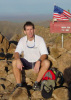
that's a depressing pic RedRoxx44
http://hikearizona.com/dex2/album_page.php?pic_id=319
thanks for sharing
http://hikearizona.com/dex2/album_page.php?pic_id=319
thanks for sharing
- joe
contribute to this member driven resource
ie: RS > Save/Share after hikes
-
 hikngrlGuides: 0 | Official Routes: 0Triplogs Last: 414 d | RS: 0Water Reports 1Y: 0 | Last: never
 - Joined: Feb 26 2003 9:20 am
- City, State: Peoria, AZ
contribute to this member driven resource
ie: RS > Save/Share after hikes
-
 plummer150Guides: 0 | Official Routes: 0Triplogs Last: 8,508 d | RS: 0Water Reports 1Y: 0 | Last: never
 - Joined: Sep 11 2002 4:19 pm
- City, State: Va Beach, Va
- Contact:
re:
Thats a shame. However, I myself can't wait to hike up Mt. Lemmon one day! Maybe this Dec/Jan.
"IRONMAN" cometh, hiketh, destroyeth
contribute to this member driven resource
ie: RS > Save/Share after hikes
-
 mtoomeyazGuides: 0 | Official Routes: 0Triplogs Last: 8,630 d | RS: 0Water Reports 1Y: 0 | Last: never
 - Joined: Apr 09 2002 7:08 am
- City, State: Gilbert, AZ
I'm sorry, but I just don't get too worked up over these things. I see it as nature at work. In the long run that is how we get things like this:
http://hikearizona.com/phoZOOM.php?ZIP=3740
Hang in there!
http://hikearizona.com/phoZOOM.php?ZIP=3740
Hang in there!
Mike T
-------------------------------------------------
Less is more
-------------------------------------------------
Less is more
contribute to this member driven resource
ie: RS > Save/Share after hikes
-
 azhiker96Guides: 0 | Official Routes: 0Triplogs Last: 1,176 d | RS: 2Water Reports 1Y: 0 | Last: never
 - Joined: Feb 03 2002 10:17 am
- City, State: Gilbert, AZ
contribute to this member driven resource
ie: RS > Save/Share after hikes
-
mtoomeyazGuides: 0 | Official Routes: 0Triplogs Last: 8,630 d | RS: 0Water Reports 1Y: 0 | Last: never
- Joined: Apr 09 2002 7:08 am
- City, State: Gilbert, AZ
Hey, does anyone know if they decided if that fire was natural or human caused? I remember there was a lot of lightning in the area at the time, but there was also talk of possible human involvement early on before any thorough investigation could be done. Any final outcome?
Mike T
-------------------------------------------------
Less is more
-------------------------------------------------
Less is more
contribute to this member driven resource
ie: RS > Save/Share after hikes
-
 whereveriroamGuides: 8 | Official Routes: 0Triplogs Last: 909 d | RS: 0Water Reports 1Y: 0 | Last: 916 d
 - Joined: Mar 07 2003 3:14 pm
- City, State: Apache Junction, AZ
It was human caused. What I've heard is that thanks to satellite surveillance from big brother up above they got an overhead photo of 6 vehicles at the TH along with images of 2 older folks and 3 males in their 20's on the trail around the time of ignition. Help is needed in solving this case. As far as I'm concerned whoever started this blaze should be tied to a tree and.....
contribute to this member driven resource
ie: RS > Save/Share after hikes
-
mtoomeyazGuides: 0 | Official Routes: 0Triplogs Last: 8,630 d | RS: 0Water Reports 1Y: 0 | Last: never
- Joined: Apr 09 2002 7:08 am
- City, State: Gilbert, AZ
Okay. While I hope that the responsible parties are brought to justice, does that "satellite surveillance" creep out anyone else?whereveriroam wrote:It was human caused. What I've heard is that thanks to satellite surveillance from big brother up above they got an overhead photo of 6 vehicles at the TH along with images of 2 older folks and 3 males in their 20's on the trail around the time of ignition.
Mike T
-------------------------------------------------
Less is more
-------------------------------------------------
Less is more
contribute to this member driven resource
ie: RS > Save/Share after hikes
-
 RodneyGuides: 2 | Official Routes: 0Triplogs Last: 8,913 d | RS: 0Water Reports 1Y: 0 | Last: never
 - Joined: Jul 06 2002 1:43 am
- City, State: Indian-a
- Contact:
I use it all the time to get a top perspective on certain areas. The fact that they still need help solving the fire starting above shows that they really can't tell much from the pictures they get with regular monitoring.mike t wrote:does that "satellite surveillance" creep out anyone else?
Hey RedRoxx44, we did the same trip you did about a week after you. We were in our passenger car...so, needless to say, we did not go back down the same way we came up!
Rodney
http://www.wolfcs.com
http://www.wolfcs.com
contribute to this member driven resource
ie: RS > Save/Share after hikes
-
 pfredricksGuides: 0 | Official Routes: 0Triplogs Last: 4,976 d | RS: 0Water Reports 1Y: 0 | Last: never
 - Joined: Oct 18 2002 10:59 am
- City, State: Glendale, AZ
satellite
Yes, Satellite spying is very good these days.
IN fact, I am using a satellite to spy on you right now.
To prove it, I will tell you that you are sitting directly in front of your computer at this very second.
amazing, huh???
-Pete
makes you kind of nervous doesn't it
IN fact, I am using a satellite to spy on you right now.
To prove it, I will tell you that you are sitting directly in front of your computer at this very second.
amazing, huh???
-Pete
makes you kind of nervous doesn't it
"I'd feel better if we had some crampons. Oh, what the hell, let's go for it..." — Common climbing last words.
contribute to this member driven resource
ie: RS > Save/Share after hikes
-
mtoomeyazGuides: 0 | Official Routes: 0Triplogs Last: 8,630 d | RS: 0Water Reports 1Y: 0 | Last: never
- Joined: Apr 09 2002 7:08 am
- City, State: Gilbert, AZ
Re: satellite
In response to pfredricks' reply:
Nice try. But my house is wrapped in lead...and tin foil... in a bunker... under a dairy farm.
Nice try. But my house is wrapped in lead...and tin foil... in a bunker... under a dairy farm.
Mike T
-------------------------------------------------
Less is more
-------------------------------------------------
Less is more
contribute to this member driven resource
ie: RS > Save/Share after hikes
-
pfredricksGuides: 0 | Official Routes: 0Triplogs Last: 4,976 d | RS: 0Water Reports 1Y: 0 | Last: never
- Joined: Oct 18 2002 10:59 am
- City, State: Glendale, AZ
yes
yes, I know (all)
love,
big brother
love,
big brother
"I'd feel better if we had some crampons. Oh, what the hell, let's go for it..." — Common climbing last words.
contribute to this member driven resource
ie: RS > Save/Share after hikes