 Route Editor

Hi,
I'm returning to the Superstitions in a couple of weeks to hike the east/central portion, starting at Reavis trailhead and doing the frog tanks/reavis loop. I was thinking of extending this with a hike up Fish Creek and then back down JF Trail to Tortilla Pass and up to Angel Basin before completing the loop.
I'm a bit worried about water availablility in the area, though, given the recent dry spell after the promising late summer rains. Can anybody who's been in this area recently clue me in to the water conditions? In particular, I'm wondering about Paradise/Plow Saddle Spring, water in Fish Creek by Frog Tanks trail, Kane Spring, Mullins Spring, Roger's Canyon (by the ruins), and Reavis Creek (well, I think I have an answer for that last one:P).
Some of these springs are listed on the forest service (or superstition search and rescue's) water report, while some aren't but have been reported elsewhere to be reliable. I called the Mesa Ranger District to get some advice, but they weren't of too much help; I thought I'd ask the rest of you to help me out so I can rest a bit easier while planning the hike.
Of course, any miscellaneous feedback about my route would be appreciated, too! I've only been in the western half of the park, so this is my first time out in the east.
Water for hike in east/central supes
Moderators: Backpack Specialist, HAZ - Moderators
Linked Guides none
Linked Area, etc none
-
 nwesfdGuides: 0 | Official Routes: 0Triplogs Last: none | RS: 0Water Reports 1Y: 0 | Last: never
 - Joined: Mar 14 2007 4:49 pm
- City, State: madison, wi
contribute to this member driven resource
ie: RS > Save/Share after hikes 

-
nwesfdGuides: 0 | Official Routes: 0Triplogs Last: none | RS: 0Water Reports 1Y: 0 | Last: never
- Joined: Mar 14 2007 4:49 pm
- City, State: madison, wi
Re: Water for hike in east/central supes
Oh, and one other thing: Have there been many recent car breakins at the eastern superstitions trailheads? My uncle and I went backpacking in the Mazatzals from Sheep Bridge last winter, and his truck was broken into while we were out. Forgive me if I'm a bit paranoid;)
contribute to this member driven resource
ie: RS > Save/Share after hikes
-
 LizardGuides: 15 | Official Routes: 0Triplogs Last: 5,506 d | RS: 0Water Reports 1Y: 0 | Last: never
 - Joined: Feb 05 2002 6:40 pm
- City, State: Phoenix, AZ
I've only found water in Roger's Canyon near the ruins after rain. I wouldn't count on water in this spot.
There is near permanent water in Fish Creek upstream of the confluence w/ Roger's Canyon. At the spot where the trail crosses, there is a very large tinaja/pool that almost always has water. If this is dry, go upstream of the confluence a bit and there are very large slot pools. I've seen turtles and frogs in this little slot, and believe the water is near permanent.
Reavis Creek can probably be counted on unless you are hiking outside the regular season.
The Eastern Superstitions are much less travelled then the Western, and trailhead breakins are not much of a concern. The only area that gets any kind of real traffic is the Reavis trailhead. Even then, I wouldn't be worried about it in the same way I would at Peralta/First Water.
"Of course we weren't lost. We were merely where we shouldn't have been, without knowing exactly where that was."
contribute to this member driven resource
ie: RS > Save/Share after hikes
-
 joebartelsGuides: 264 | Official Routes: 224Triplogs Last: 2 d | RS: 2067Water Reports 1Y: 29 | Last: 1 d
 - Joined: Nov 20 1996 12:00 pm
contribute to this member driven resource
ie: RS > Save/Share after hikes
-
 te_waGuides: 3 | Official Routes: 0Triplogs Last: 4 d | RS: 2Water Reports 1Y: 0 | Last: 2,100 d
 - Joined: Aug 22 2003 9:16 pm
- City, State: Mesa
my advice? unless you enjoy a death march then do the frog tanks/reavis loop counterclockwise. Frog tanks trail is very rocky and doing this uphill would be sheer hell. Im skeptical about Lizard's description of a pool near Angel Basin, he told me there was water there and we spent a good hour looking for it. I'd like to see gps waypoints! 
squirrel!
contribute to this member driven resource
ie: RS > Save/Share after hikes
-
 hikeazGuides: 6 | Official Routes: 0Triplogs Last: 1,245 d | RS: 0Water Reports 1Y: 0 | Last: 1,244 d
 - Joined: May 13 2002 10:07 am
- City, State: Tempe, AZ
- Contact:
I have found that the big pool (big enough to need to climb around) just below the spring is in fact DOWNstream of the confluence about 5-6 minutes.mikeinFHAZ wrote: Im skeptical about Lizard's description of a pool near Angel Basin, he told me there was water there and we spent a good hour looking for it. I'd like to see gps waypoints!
My estimate of the waypoint for this pool is 33.488 x 111.22257. (+/-)
Not to say there is not onethere, but I have not found a spring upstream of the confluence in dry times.
nwesfd, from the Reavis T/H; would you be hiking down Frog Tanks? Would you then head DOWN Fish Creek and then bushwhack up to the JF (on the ramp NW of Lost Dutch Sp.- BTW - it looks OK on a topo, but is kinda thick with brush) and on to Tortilla Pass and then take the Rogers' down to A.B., then up the Rogers' to the Reavis Trail and into Reavis Ranch, and then out the Reavis to the T/H?nwesfd wrote:Hi,
I'm returning to the Superstitions in a couple of weeks to hike the east/central portion, starting at Reavis trailhead and doing the frog tanks/reavis loop. I was thinking of extending this with a hike up Fish Creek and then back down JF Trail to Tortilla Pass and up to Angel Basin before completing the loop.
"The censorship method ... is that of handing the job over to some frail and erring mortal man, and making him omnipotent on the assumption that his official status will make him infallible and omniscient."
George Bernard Shaw
George Bernard Shaw
contribute to this member driven resource
ie: RS > Save/Share after hikes
-
nwesfdGuides: 0 | Official Routes: 0Triplogs Last: none | RS: 0Water Reports 1Y: 0 | Last: never
- Joined: Mar 14 2007 4:49 pm
- City, State: madison, wi
Wow, thanks for all the responses, everyone! If any of you ever need advice for hiking in... err... Wisconsin or the UP of Michigan... I'll be more than glad to (modestly) return the favor;).
Yup, that's the plan. If things turn out to be a bit too hot, too dry, or too brushy, we'll tighten the hike to just the Frog Tanks/Rogers/Reavis loop. On paper, it looks like a loop that sees a good range of areas and has reliable water sources nearby (maybe having to skip over to Kane spring after hopping out of Fish Creek). I've bushwhacked in the desert before (some of those trails in the Mazatzals were faint to nonexistent) and feel like I can handle a mile or so at a time... Am I in for worse?:Phikeaz wrote:
nwesfd, from the Reavis T/H; would you be hiking down Frog Tanks? Would you then head DOWN Fish Creek and then bushwhack up to the JF (on the ramp NW of Lost Dutch Sp.- BTW - it looks OK on a topo, but is kinda thick with brush) and on to Tortilla Pass and then take the Rogers' down to A.B., then up the Rogers' to the Reavis Trail and into Reavis Ranch, and then out the Reavis to the T/H?
contribute to this member driven resource
ie: RS > Save/Share after hikes
-
nwesfdGuides: 0 | Official Routes: 0Triplogs Last: none | RS: 0Water Reports 1Y: 0 | Last: never
- Joined: Mar 14 2007 4:49 pm
- City, State: madison, wi
contribute to this member driven resource
ie: RS > Save/Share after hikes
-
nwesfdGuides: 0 | Official Routes: 0Triplogs Last: none | RS: 0Water Reports 1Y: 0 | Last: never
- Joined: Mar 14 2007 4:49 pm
- City, State: madison, wi
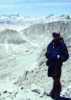
Thanks so much to everyone who offered their advice to me; luckily water was plentiful in the backcountry (due to the inch or so of rain the week previous to our trip), even appearing in many unexpected places. The temperatures were bearable as well, making for an all-around wonderful trip.
I'd also like to say thanks to some of the very helpful people we met on the trail: the older gentleman who warned us that Kane Spring might be dry and gave us two liters of his water (although Kane Spring was indeed stocked), and the father hiking with his son who gave us photocopies sections of the Hiker's Guide at Reavis Saddle (we were using the guides written by Grubbs, who I can't say I recommend). We enjoyed our long stretches of solitude in the wilderness, but people like these are welcome sights.
The trip itself was tough but very rewarding. The scenery back in that area is stunning and the riparian areas are enchanting. The trip up Fish Creek was definitely the toughest part (we had to ferry our packs across a pool at one point, then gaining the ridge to reach the JF Trail was tough after the long day), but also the most rewarding by far.
The only problems we experienced were self-inflicted. I had resoled by boots at a cobbler a couple of weeks before the trip, and the gluing around the side starting coming undone on the second day; shoelaces tied around the boots kept them together pretty admirably. I also managed to poke a hole in my therm-a-rest, but fortunately it was a slow leak so I was fine waking up every few hours and reinflating it.
I've posted my pictures at http://picasaweb.google.com/sfdiehl/Superstitions
Please let me know if any of my labelings of the pictures are off the mark.
Scott:)
contribute to this member driven resource
ie: RS > Save/Share after hikes
-
 djui5Guides: 0 | Official Routes: 0Triplogs Last: none | RS: 0Water Reports 1Y: 0 | Last: never
 - Joined: May 18 2006 1:59 am
- City, State: Apache Junction, AZ
contribute to this member driven resource
ie: RS > Save/Share after hikes