 Route Editor

Hello!
My wife and I want to do the West Fork trail in a couple weeks. We wanted to hike it end to end, but won't be able to do the shuttle bit. Does anybody know, if we have two nights, which would be better--roundtrip from the bottom, touristy area, or from the top, FR 231? I've never been down from the top at all, but I used to hike up a bit from the bottom. Our hopes are: some adventure, a decent camping spot, a scenic experience on the whole.
Anybody know the conditions up there lately? As well as the conditions of FR 231, should we pick that option? Also, is it strenuous hiking up the trail--i.e., if we choose the FR 231 option, will it be a pain in the ?@# hiking back up on our last day, or just fun?
I'm assuming we should forgo the tent, the backpack, and opt for the dry bag, correct? Any more advice from people who've done the whole trail (or the roundtrip from one end option) would be a big help.
Thanks everyone!
Jeff
West Fork Oak Creek trip
Moderators: Backpack Specialist, HAZ - Moderators
Linked Area, etc none
-
 jsm335Guides: 0 | Official Routes: 0Triplogs Last: none | RS: 0Water Reports 1Y: 0 | Last: never
 - Joined: Nov 13 2007 12:16 pm
- City, State: Ithaca, NY
contribute to this member driven resource
ie: RS > Save/Share after hikes 

-
 hikeazGuides: 6 | Official Routes: 0Triplogs Last: 1,239 d | RS: 0Water Reports 1Y: 0 | Last: 1,238 d
 - Joined: May 13 2002 10:07 am
- City, State: Tempe, AZ
- Contact:
Re: West Fork Oak Creek trip
I've hiked this creek a few times, both as a backpack and a through-hike, and I'd say that 231 should be in good shape - it's pretty well maintained, as it is a main thoroughfare, as forest roads go.
I don't know if I'd forgo a tent, as the monsoons are here. I would advise a nice tarp at least. BUT, there are a few camps to be found under overhangs that might suit you, but they may not be where you NEED them to be, time-wise. There are not a ton of camping spots, especially right in the canyon - in some of the areas there is a nice bench system up about 20'-30' from the canyon bottom - good camp spots can often be found on these benches.
I generally use a 'boundary bag' for the trip, tethered with about 15' of cord tied around my waist for the swims.
The elevation differential between top & bottom is about 1800'; so, over 12-ish miles, that's not terrible.
re. Which end to start.... I would say to start @ Woody Mountain and avoid 3 days of paying the Red Rock extortion fees @ WFOC parking lot. Plus, that way the last memories you have of the trip won't be hundreds of tourists milling about.
It's a terrific, scenic and generally solitude-filled trip. Have fun & be safe.
"The censorship method ... is that of handing the job over to some frail and erring mortal man, and making him omnipotent on the assumption that his official status will make him infallible and omniscient."
George Bernard Shaw
George Bernard Shaw
contribute to this member driven resource
ie: RS > Save/Share after hikes
-
jsm335Guides: 0 | Official Routes: 0Triplogs Last: none | RS: 0Water Reports 1Y: 0 | Last: never
- Joined: Nov 13 2007 12:16 pm
- City, State: Ithaca, NY
Re: West Fork Oak Creek trip
Hey, great advice, thanks!
Does anyone know where the overhangs are, in general, as far as mileage? I'll bring a topo map, but I don't believe they'll be on there.
Does anyone know where the overhangs are, in general, as far as mileage? I'll bring a topo map, but I don't believe they'll be on there.
contribute to this member driven resource
ie: RS > Save/Share after hikes
-
hikeazGuides: 6 | Official Routes: 0Triplogs Last: 1,239 d | RS: 0Water Reports 1Y: 0 | Last: 1,238 d
- Joined: May 13 2002 10:07 am
- City, State: Tempe, AZ
- Contact:
Re: West Fork Oak Creek trip
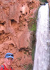
There is one well-known overhang about 4.5 miles in from the bottom - it's on creek left on a small bench about 10' above the creekbottom.(photo link below).jsm335 wrote:Hey, great advice, thanks!
Does anyone know where the overhangs are, in general, as far as mileage? I'll bring a topo map, but I don't believe they'll be on there.
Also, above that, up on the bench, but back toward the canyon's main wall is a sort-of 'cave'... more like an alcove really. It's big - sleeping maybe 6-8?
Understand that some of the overhang camps are not necessarily easily found, just look at the geology... after a bit of hiking in there it will become more obvious to you as to where there would be a good chance of one.
Remember.. " an adventure is merely an inconvience rightly considered"
Photo link >> igallery/image.php?pic_id=3528
"The censorship method ... is that of handing the job over to some frail and erring mortal man, and making him omnipotent on the assumption that his official status will make him infallible and omniscient."
George Bernard Shaw
George Bernard Shaw
contribute to this member driven resource
ie: RS > Save/Share after hikes
-
 Davis2001r6Guides: 6 | Official Routes: 14Triplogs Last: 5,906 d | RS: 0Water Reports 1Y: 0 | Last: never
 - Joined: Dec 06 2003 3:27 am
- City, State: Bordeaux, France
- Contact:
Re: West Fork Oak Creek trip
I think the spot Kurt mentions is pretty easy to find, I've stopped there for lunch each time I've done the hike. Still would like to overnight there sometime.
contribute to this member driven resource
ie: RS > Save/Share after hikes
-
 te_waGuides: 3 | Official Routes: 0Triplogs Last: 1,895 d | RS: 2Water Reports 1Y: 0 | Last: 2,094 d
 - Joined: Aug 22 2003 9:16 pm
- City, State: Mesa
Re: West Fork Oak Creek trip
it was my understanding that camping within the 6 miles from the lower trailhead is illegal... that may have changed, Im not sure. Just dont get caught! 
I agree going in from the top @ Woody Mtn road. Park just north of the cattle guard (the Red Rock wilderness boundary) for free.
one of the ways I have done some light canyoneering is using a durable pack liner, if you have a pack that doesnt weigh a lot after a dunk... trash compactor bags, x-large ziplock bag, or pack liners from Gossamer Gear or even the largest Turkey bag could work. Depends on your pack size. The easiest method for a liner bag is to use your pack as a raft and swim with it. Towing a pack never quite felt right to me. YMMV.
squirrel!
contribute to this member driven resource
ie: RS > Save/Share after hikes
-
hikeazGuides: 6 | Official Routes: 0Triplogs Last: 1,239 d | RS: 0Water Reports 1Y: 0 | Last: 1,238 d
- Joined: May 13 2002 10:07 am
- City, State: Tempe, AZ
- Contact:
Re: West Fork Oak Creek trip
Oh... yeah... right.... rules........... I meant 6.00784321 miles in from the bottom....... yeah..... THAT's what I meant. ;)te-wa wrote:it was my understanding that camping within the 6 miles from the lower trailhead is illegal...
With the conversion of USFS Red Rock personnel from backcountry folks to Meter Maids, I'd say that you would be as safe as can be ANYWHERE in the backcountry.
"The censorship method ... is that of handing the job over to some frail and erring mortal man, and making him omnipotent on the assumption that his official status will make him infallible and omniscient."
George Bernard Shaw
George Bernard Shaw
contribute to this member driven resource
ie: RS > Save/Share after hikes
-
te_waGuides: 3 | Official Routes: 0Triplogs Last: 1,895 d | RS: 2Water Reports 1Y: 0 | Last: 2,094 d
- Joined: Aug 22 2003 9:16 pm
- City, State: Mesa
Re: West Fork Oak Creek trip
hey I didnt say you cant break rules. Im all for it! yeehaw!
just dont get caught. when i camp where y'aint supposed to, i'll wear mute colors and hang/sleep ingognito
just dont get caught. when i camp where y'aint supposed to, i'll wear mute colors and hang/sleep ingognito
squirrel!
contribute to this member driven resource
ie: RS > Save/Share after hikes
-
Davis2001r6Guides: 6 | Official Routes: 14Triplogs Last: 5,906 d | RS: 0Water Reports 1Y: 0 | Last: never
- Joined: Dec 06 2003 3:27 am
- City, State: Bordeaux, France
- Contact:
Re: West Fork Oak Creek trip
Well the first 3 miles is the trail down to the creek isn't it? So if that counts towards the 6 then you should be ok. It's definitely an established camping spot thats for sure.
contribute to this member driven resource
ie: RS > Save/Share after hikes
-
jsm335Guides: 0 | Official Routes: 0Triplogs Last: none | RS: 0Water Reports 1Y: 0 | Last: never
- Joined: Nov 13 2007 12:16 pm
- City, State: Ithaca, NY
Re: West Fork Oak Creek trip
I'm not at all opposed to some guerilla camping.
That overhang spot sounds like a potential 2nd night site. I wonder how difficult, and time-consuming, it will be to hike back up to the top from there on the third day.
I had planned on getting something similar to the boundary bag. Actually, Outdoorplay has a backpacking harness, without the pack itself, to hold drybags, dryboxes, etc. which is pretty cool, but as I was looking at drybags, I realized I should just get a $20 drybag and line the inside of my normal pack with it. Duh.
Should be a great trip.
contribute to this member driven resource
ie: RS > Save/Share after hikes
-
Davis2001r6Guides: 6 | Official Routes: 14Triplogs Last: 5,906 d | RS: 0Water Reports 1Y: 0 | Last: never
- Joined: Dec 06 2003 3:27 am
- City, State: Bordeaux, France
- Contact:
Re: West Fork Oak Creek trip
I think the majority of people who do the hike, do it as a dayhike. So shouldn't be too difficult to make it back up in a day, just don't go crazy with what you pack.
contribute to this member driven resource
ie: RS > Save/Share after hikes
-
 scorpion scusGuides: 0 | Official Routes: 0Triplogs Last: 6,355 d | RS: 0Water Reports 1Y: 0 | Last: never
 - Joined: Aug 12 2005 6:03 pm
- City, State: Phoenix, AZ
Re: West Fork Oak Creek trip
put grommets in the bottom of your pack for drainage home depot has the really big ones rei ones work too about half inch, but the big ones will drain faster
contribute to this member driven resource
ie: RS > Save/Share after hikes
-
jsm335Guides: 0 | Official Routes: 0Triplogs Last: none | RS: 0Water Reports 1Y: 0 | Last: never
- Joined: Nov 13 2007 12:16 pm
- City, State: Ithaca, NY
Re: West Fork Oak Creek trip
That's a great tip. I didn't even think about the bag filling up with 10 gallons of water. I'll do that.
contribute to this member driven resource
ie: RS > Save/Share after hikes
-
hikeazGuides: 6 | Official Routes: 0Triplogs Last: 1,239 d | RS: 0Water Reports 1Y: 0 | Last: 1,238 d
- Joined: May 13 2002 10:07 am
- City, State: Tempe, AZ
- Contact:
Re: West Fork Oak Creek trip
There are not near as many pools in WFOC, but some of the gear discoveries we made a few years ago hiking in the Tonto Creek are apropos. >> http://hikearizona.com/decoder.php?ZTN=587
"The censorship method ... is that of handing the job over to some frail and erring mortal man, and making him omnipotent on the assumption that his official status will make him infallible and omniscient."
George Bernard Shaw
George Bernard Shaw
contribute to this member driven resource
ie: RS > Save/Share after hikes
-
jsm335Guides: 0 | Official Routes: 0Triplogs Last: none | RS: 0Water Reports 1Y: 0 | Last: never
- Joined: Nov 13 2007 12:16 pm
- City, State: Ithaca, NY
Re: West Fork Oak Creek trip
One final question, perhaps the most important of them. I haven't read much, if anything, warning about flash flooding in the canyon. Does anybody have any insight into this? Growing up in AZ, flash floods were always an issue, but strangely never brought up here as a hazard. Should we worry, as we're going this weekend?
contribute to this member driven resource
ie: RS > Save/Share after hikes
-
te_waGuides: 3 | Official Routes: 0Triplogs Last: 1,895 d | RS: 2Water Reports 1Y: 0 | Last: 2,094 d
- Joined: Aug 22 2003 9:16 pm
- City, State: Mesa
Re: West Fork Oak Creek trip
I dont think WF is going to give you a serious problem, if there are rainclouds near and you get very heavy rain you will have time to get upon high ground. The canyon simply isnt long enough I dont think, to get a flash without seeing its origin. Tonto Narrows, is a different story altogether.
play it safe and expect/prepare for daily rainshowers which may vary from .001 inch to well over 1 inch precip. That dry, extreme western side of the Rim is fairly predictable tho so just look at the skies once in a while. we want pics, BTW.
play it safe and expect/prepare for daily rainshowers which may vary from .001 inch to well over 1 inch precip. That dry, extreme western side of the Rim is fairly predictable tho so just look at the skies once in a while. we want pics, BTW.
squirrel!
contribute to this member driven resource
ie: RS > Save/Share after hikes
-
jsm335Guides: 0 | Official Routes: 0Triplogs Last: none | RS: 0Water Reports 1Y: 0 | Last: never
- Joined: Nov 13 2007 12:16 pm
- City, State: Ithaca, NY
Re: West Fork Oak Creek trip
Thanks for the info. We're terrible about pics. I'll take some, but they'll be crappy disposable and lo res camera phone. We're a couple of luddites, in certain ways.
contribute to this member driven resource
ie: RS > Save/Share after hikes
-
jsm335Guides: 0 | Official Routes: 0Triplogs Last: none | RS: 0Water Reports 1Y: 0 | Last: never
- Joined: Nov 13 2007 12:16 pm
- City, State: Ithaca, NY
Re: West Fork Oak Creek trip
Back from the trip. First of all, no photos--my camera phone decided to erase everything I had out of the blue. A bit disappointing to say the least. As for the trip, we were forced to turn back after a couple of hours of hiking, as there is no water for at least the first 2 1/2-3 miles of the upper West Fork. We had planned on filtering water after our 2-Nalgene supply ran out, but after hiking in hot sun for some time, seeing not even a hint of water anywhere, I went ahead of my partner packless to check the situation further on. After about another 1/3-1/2 mile (with some serious boulder scrambling on the way), I saw no running water at all, but stopped at a stagnant pool in the boulders a couple meters wide and a foot deep, full of bugs and scum. I turned back from there, seeing no point in soaking my feet since I hadn't been wet at all, as it was looking like the trip would be aborted. Looking down the canyon a ways, there was no sign of any other water source. Clouds were building above, and we were running out of water, so I ran back to my partner, grabbed the bottles and pump, and ran again to the pool and filled them (that disgusting little slimehole tasted great, by the way--thank god for filters). On my way back to my partner, the skies opened up, and we took shelter above the creekbed under an overhang. We were soaked, and waited about 1/2 hour sipping whiskey and trying to dry off a bit. The rain did slow, but never quite stopped on the difficult hike back to the trailhead.
In summary, the upper West Fork from the FR 231 bridge trailhead to about 2 1/2-3 miles in is completely dry. I've never seen the lower West Fork dry in my life, so I'm not sure where this water is coming from. I was quite surprised by this, considering the amount of research I did, and all the talk of swimming. Does anybody have any insight into this? Where is the lower creek's water coming from? Does it dry up later in the season? I've never witnessed that. I hope we didn't turn back just short of some cascading spring gushing out of the cliffside. Although I doubt that's the case.
This trail (or lack thereof) from the upper end is very slow going, so account for that, as well. A disappointment in the end, but it was beautiful in there nonetheless. I'll try it again if I can get some more info.
contribute to this member driven resource
ie: RS > Save/Share after hikes
-
Davis2001r6Guides: 6 | Official Routes: 14Triplogs Last: 5,906 d | RS: 0Water Reports 1Y: 0 | Last: never
- Joined: Dec 06 2003 3:27 am
- City, State: Bordeaux, France
- Contact:
Re: West Fork Oak Creek trip
Well the lower half is definitely the better half of the canyon for views. There is definitely water down there as well. I'll be thru hiking it next month for the 4th or 5th time and will count on some swimmers. The top half is a lot of boulder hopping and slow going as you figured out. Sorry the trip didn't go as planned for you.
-TIM-
-TIM-
contribute to this member driven resource
ie: RS > Save/Share after hikes
-
 cactusrose63Guides: 0 | Official Routes: 0Triplogs Last: 4,320 d | RS: 0Water Reports 1Y: 0 | Last: never
 - Joined: Jun 30 2008 3:55 pm
- City, State: Tucson, AZ
Re: West Fork Oak Creek trip
Well it seems as though it has been five years since this was posted....how does that happen?? So many hikes, so little time. Looking for updated information for anyone who has done this hike recently. My husband and his friend want to do this hike within the next year or so. Can anyone comment on best time of year for water supply since that was a concern as posted by jsm335. Directions from Flag or Sedona to FR 231? I will get out my FS map and check it out also. Thanks for your help.
Barb
Barb
contribute to this member driven resource
ie: RS > Save/Share after hikes