 Route Editor

Hey everyone,
I can swing a hike on Monday, and would love to save some gas $$$ and do a local hike, was thinking about doing a morning hike to a swimming hole and then busting back out by noon or just thereafter, before the heat (or storms) get really nasty (currently, the hi is only set for 100 degrees here on Monday). Not seeing a lot of options tho...
I did see Fish Creek Upper Canyon, was thinking about that, as it seems a fairly quick hike in/out. What would you all recommend??
dave
Phoenix water hike options / July 14?
Moderator: HAZ - Moderators
Linked Guides none
Linked Area, etc none
-
 azdesertfatherGuides: 16 | Official Routes: 21Triplogs Last: 3 d | RS: 18Water Reports 1Y: 2 | Last: 334 d
 - Joined: Apr 30 2008 9:57 am
- City, State: Tucson, AZ
- Contact:
Phoenix water hike options / July 14?
"I went to the woods because I wished to live deliberately, to front only the essential facts of life, and see if I could not learn what it had to teach, and not, when I came to die, discover that I had not lived." — Henry David Thoreau
contribute to this member driven resource
ie: RS > Save/Share after hikes 

-
 joebartelsGuides: 264 | Official Routes: 224Triplogs Last: 2 d | RS: 2067Water Reports 1Y: 29 | Last: 2 d
 - Joined: Nov 20 1996 12:00 pm
Re: Phoenix water hike options / July 14?
There won't be much water, which will make the hike easier/quicker. With the huge walls you get free morning shade. However I'd still plan on being out by 9am or you'll roast in the sauna!
Personally I'd wait for a hotter dry day then mess around with the humidity
Glad you made it back from India okay!
Personally I'd wait for a hotter dry day then mess around with the humidity
Glad you made it back from India okay!
- joe
contribute to this member driven resource
ie: RS > Save/Share after hikes
-
 rally_toadGuides: 22 | Official Routes: 3Triplogs Last: 1,063 d | RS: 60Water Reports 1Y: 0 | Last: never
 - Joined: May 17 2007 8:06 pm
- City, State: CA
Re: Phoenix water hike options / July 14?
Rumor has it we got some rain here in the last few days. I was in flagstaff so I cant confirm that the rumors are true.
La Barge Lower Box is a favorite of mine, water is in there year round, so you might be able to find enough to swim or wade in since we got some rain(this is the canyon we looked down on from on top of Battleship) but it is a 9 mile hike. Fish Creek sounds interesting but I've never been there. Another one I've looked at and wanted to try but havent yet is Sycamore Canyon from Bushnell tanks off the beeline hwy. Romero Pools is a classic, that one is kinda far, but not too far of a drive. Tonto Narrows is one I've heard good things about but that is most of the way to Payson, so kinda far again.
Maybe Sunrise Arch in the Goldfield Mtns. in the morning? and then a dip in the Salt River on the hike back? Thats the closest swimming I can think of, but that portion of the Salt River is trashed.
"Who are you guys??!!" -Farnsworth
contribute to this member driven resource
ie: RS > Save/Share after hikes
-
 SuperstitionGuyGuides: 0 | Official Routes: 0Triplogs Last: 1,831 d | RS: 0Water Reports 1Y: 0 | Last: never
 - Joined: Dec 25 2005 8:24 pm
- City, State: Queen Creek, Arizona
Re: Phoenix water hike options / July 14?
Do the upper Fish Creek. Park by the bridge at the crack of dawn and hike beyound the common turn around point where the trash and trail stops. There will be shade until about 10 AM depending on how far you go up the canyon. Give us a report on the flow of Tortilla Creek where it crosses the road at Tortilla Flat. This is a good judge of how much water will be in the other drainages as well. Have fun, be safe and stop at Tortilla Flat on the way out and enjoy a scoop of their Prickly Pear Ice cream. Take some pictures and give us a report.....
:thanx:
:thanx:
A man's body may grow old, but inside his spirit can still be as young and restless as ever.
- Garth McCann from the movie Second Hand Lions
Another victim of Pixel Trivia.
Current avatar courtesy of Snakemarks
- Garth McCann from the movie Second Hand Lions
Another victim of Pixel Trivia.
Current avatar courtesy of Snakemarks
contribute to this member driven resource
ie: RS > Save/Share after hikes
-
azdesertfatherGuides: 16 | Official Routes: 21Triplogs Last: 3 d | RS: 18Water Reports 1Y: 2 | Last: 334 d
- Joined: Apr 30 2008 9:57 am
- City, State: Tucson, AZ
- Contact:
Re: Phoenix water hike options / July 14?
Thanks everyone. At the last minute, I had to work anyway  But I'm still hoping to keep this Friday open and go. If I can go, will let you know what water levels I see then ;)
"I went to the woods because I wished to live deliberately, to front only the essential facts of life, and see if I could not learn what it had to teach, and not, when I came to die, discover that I had not lived." — Henry David Thoreau
contribute to this member driven resource
ie: RS > Save/Share after hikes
-
azdesertfatherGuides: 16 | Official Routes: 21Triplogs Last: 3 d | RS: 18Water Reports 1Y: 2 | Last: 334 d
- Joined: Apr 30 2008 9:57 am
- City, State: Tucson, AZ
- Contact:
Re: Phoenix water hike options / July 14?
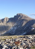
Went, here's a report with a few pics ... http://hikearizona.com/photocodeZOOM.php?ID=5833&TNI=44SuperstitionGuy wrote:Do the upper Fish Creek. Park by the bridge at the crack of dawn and hike beyound the common turn around point where the trash and trail stops. There will be shade until about 10 AM depending on how far you go up the canyon. Give us a report on the flow of Tortilla Creek where it crosses the road at Tortilla Flat. This is a good judge of how much water will be in the other drainages as well. Have fun, be safe and stop at Tortilla Flat on the way out and enjoy a scoop of their Prickly Pear Ice cream. Take some pictures and give us a report.....
:thanx:
"I went to the woods because I wished to live deliberately, to front only the essential facts of life, and see if I could not learn what it had to teach, and not, when I came to die, discover that I had not lived." — Henry David Thoreau
contribute to this member driven resource
ie: RS > Save/Share after hikes