 Route Editor

We have all heard the stories of hikers stumbling across illegal dope grows out in the national forest, the Mexican Cartels, and the 'no go' areas of CA. These drug growers damage the forest, poach wildlife, and have been known to shoot hikers who happen across them. An article in USA Today, Aug 19, told that the latest CA fire was started by the Cartel boys while cooking dinner at one of their grows. As an environmentalist, it pisses me off that this is happening in our public lands.
We hikers can help keep our national forests safe by reporting grow sites and suspicious activity to the authorities. I found a grow two years ago in the Matazals, a quarter mile east of the Arizona Trail near a popular Boy Scout Camp site. So, M-16 toting illegal aliens are that close to your kids out there. No better reason to shut them down. I do not advocate others to go out looking for grows; but it is fun for those of us with nothing to lose, hiking off trail in the manzanita, seeing remotest of places.
I was wondering if there are any others in the club who like to go 'hunting', and if anyone has any tips or suggestions to help out. The best places to look are around reliable water sources, like springs, wells, creeks,etc. However, there are just so many miles and miles of territory out there to search, even with aids like sat maps and the like, it is difficult to find anything. The Bradshaws have had some busts, as have the Rim area and Matazals. Gila County is also a good area. This weekend will be a hike along the feeder streams of Cherry Creek, just east of the Sierra Anchas.
Lets keep the comments on topic and not about the question of legalization of marijuana, or whether getting stoned is a good idea or not. There is plenty of material here in which to bash or ridicule without the aid of those tired arguments. Yes, the mission is potentially dangerous, but not any more dangerous than walking through South Phoenix after dark. Besides, the odds of finding a grow are about zero unless you put in a bunch of miles intelligently.
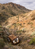
Here is a pic of the trash left behind at the Matazal grow site. Thousands of starter dixie cups, plastic bird netting, a bone yard of poached wildlife, fertilizer bags, irrigation equiment, shoes, clothes, tortilla wrappers, Miracle Grow, etc. etc. Basically, the same trash you find at Organ Pipe National Monument or anywhere near the human trafficking routes.
Off Trail Dope Search
Moderator: HAZ - Moderators
Linked Guides none
Linked Area, etc none
-
 HAZ_HikebotGuides: 989 | Official Routes: 3523Triplogs Last: none | RS: 0Water Reports 1Y: 0 | Last: 688 d
 - Joined: Nov 20 1996 12:00 pm
- City, State: HAZ, TrailDEX
- Contact:
Off Trail Dope Search
For the love of god, don't PM a robot!
contribute to this member driven resource
ie: RS > Save/Share after hikes 

-
 ankaaGuides: 0 | Official Routes: 0Triplogs Last: 5,493 d | RS: 0Water Reports 1Y: 0 | Last: never
 - Joined: Jul 10 2006 4:18 pm
- City, State: Phoenix, AZ
Re: Off Trail Dope Search
That must have been what we ran into. Glad we got a late start.In September 2005, bear hunters approached a pot farm along Deer Creek, in the Mazatzal Wilderness, and were fired upon by cartel guards. The hunters returned fire and retreated to notify police.
The following year, a Forest Service tactical team raided a site in the same area and took fire from a guard carrying a semiautomatic rifle. Two men were arrested, and one escaped. The rifleman, a Mexican national who was shot in the abdomen, was eventually sentenced to 18 years in prison.
contribute to this member driven resource
ie: RS > Save/Share after hikes
-
 azdesertfatherGuides: 16 | Official Routes: 21Triplogs Last: 7 d | RS: 18Water Reports 1Y: 2 | Last: 330 d
 - Joined: Apr 30 2008 9:57 am
- City, State: Tucson, AZ
- Contact:
Re: Off Trail Dope Search
Well, I'm personally HAPPY to report that I don't have any such firsthand stories...I hope I never will!  ;)
;)
"I went to the woods because I wished to live deliberately, to front only the essential facts of life, and see if I could not learn what it had to teach, and not, when I came to die, discover that I had not lived." — Henry David Thoreau
contribute to this member driven resource
ie: RS > Save/Share after hikes
-
 joebartelsGuides: 264 | Official Routes: 224Triplogs Last: 2 d | RS: 2065Water Reports 1Y: 28 | Last: 15 d
 - Joined: Nov 20 1996 12:00 pm
Re: Off Trail Dope Search
Yeah I remember that one too, that article is totally dope.JamesLyding wrote:From the Tucson Weekly April 9, 2009:
So what is considered the grow season? Or are there several?
- joe
contribute to this member driven resource
ie: RS > Save/Share after hikes
-
 JeffshadowsGuides: 28 | Official Routes: 7Triplogs Last: 4,278 d | RS: 0Water Reports 1Y: 0 | Last: 4,436 d
 - Joined: Jan 30 2008 8:46 am
- City, State: Old Pueblo
Re: Off Trail Dope Search
From a semi-reputable source:
When cultivated outdoors, the chosen areas are those which receive twelve hours or more of sunlight in a given day. In the Northern Hemisphere cannabis seeds are typically planted in late May or early June, so the plants can have a full four months of growth. Typically, the plants are harvested anywhere from mid September to early October. In North America, northern locations are preferred (Humboldt County, California and British Columbia being particularly notable), but southern locations (such as Maui, Hawaii) are also known to be good producers.
When cultivated outdoors, the chosen areas are those which receive twelve hours or more of sunlight in a given day. In the Northern Hemisphere cannabis seeds are typically planted in late May or early June, so the plants can have a full four months of growth. Typically, the plants are harvested anywhere from mid September to early October. In North America, northern locations are preferred (Humboldt County, California and British Columbia being particularly notable), but southern locations (such as Maui, Hawaii) are also known to be good producers.
AD-AVGVSTA-PER-ANGVSTA
contribute to this member driven resource
ie: RS > Save/Share after hikes
-
 berkforbesGuides: 0 | Official Routes: 0Triplogs Last: 5,060 d | RS: 0Water Reports 1Y: 0 | Last: 5,158 d
 - Joined: Mar 18 2008 9:36 pm
- City, State: phoenix
- Contact:
Re: Off Trail Dope Search
summer light gives off more of the blue end of the light spectrum ( promoting foliage growth), the fall brings a more red end of the spectrum of light (promoting fruit or bud growth). no im not a pot farmer, but i am going to school for sustainable organic farming.
"Rather love, than money, than fame, give me truth."
-Henry David Thoreau
-Henry David Thoreau
contribute to this member driven resource
ie: RS > Save/Share after hikes
-
 JimmyLydingGuides: 111 | Official Routes: 94Triplogs Last: 770 d | RS: 0Water Reports 1Y: 0 | Last: 2,342 d
 - Joined: Feb 16 2007 3:17 pm
- City, State: Walnut Creek, CA
contribute to this member driven resource
ie: RS > Save/Share after hikes
-
berkforbesGuides: 0 | Official Routes: 0Triplogs Last: 5,060 d | RS: 0Water Reports 1Y: 0 | Last: 5,158 d
- Joined: Mar 18 2008 9:36 pm
- City, State: phoenix
- Contact:
Re: Off Trail Dope Search
and.... the above link is not what you think it is...
"Rather love, than money, than fame, give me truth."
-Henry David Thoreau
-Henry David Thoreau
contribute to this member driven resource
ie: RS > Save/Share after hikes
-
JimmyLydingGuides: 111 | Official Routes: 94Triplogs Last: 770 d | RS: 0Water Reports 1Y: 0 | Last: 2,342 d
- Joined: Feb 16 2007 3:17 pm
- City, State: Walnut Creek, CA
Re: Off Trail Dope Search
It's some sort of mint-y thing, but it's the closest I could come up with!
contribute to this member driven resource
ie: RS > Save/Share after hikes
-
berkforbesGuides: 0 | Official Routes: 0Triplogs Last: 5,060 d | RS: 0Water Reports 1Y: 0 | Last: 5,158 d
- Joined: Mar 18 2008 9:36 pm
- City, State: phoenix
- Contact:
Re: Off Trail Dope Search
yea it looks like mint.. lol really great crushed up in some lemonade!! mmm im thirsty now..
"Rather love, than money, than fame, give me truth."
-Henry David Thoreau
-Henry David Thoreau
contribute to this member driven resource
ie: RS > Save/Share after hikes
-
 dysfunctionGuides: 0 | Official Routes: 0Triplogs Last: 5,922 d | RS: 0Water Reports 1Y: 0 | Last: never
 - Joined: Dec 20 2008 7:38 pm
- City, State: Tucson, AZ
contribute to this member driven resource
ie: RS > Save/Share after hikes
-
berkforbesGuides: 0 | Official Routes: 0Triplogs Last: 5,060 d | RS: 0Water Reports 1Y: 0 | Last: 5,158 d
- Joined: Mar 18 2008 9:36 pm
- City, State: phoenix
- Contact:
Re: Off Trail Dope Search
i knew i was just begging to be one-upped... well done dysfunction.. hahaha
"Rather love, than money, than fame, give me truth."
-Henry David Thoreau
-Henry David Thoreau
contribute to this member driven resource
ie: RS > Save/Share after hikes
-
HAZ_HikebotGuides: 989 | Official Routes: 3523Triplogs Last: none | RS: 0Water Reports 1Y: 0 | Last: 688 d
- Joined: Nov 20 1996 12:00 pm
- City, State: HAZ, TrailDEX
- Contact:
Re: Off Trail Dope Search
Great stories and info, folks.
I love the Cherry Creek story, Azbackpacker, good thing nobody got hurt on that one. Those kids have some serious guts to sneak into an active grow site and take a 20 bound bag for a souvenir. Ha! I was just over there two weekends ago, hiking a little 15 mile loop up Bronco Canyon from Cherry Creek, then back down South Cooper Forks Creek. Plenty of water there. The Bermuda Falls area is pretty cool. You have to walk along the top of the ridge to get around the drops, and the half mile stretch below the falls (the falls part is dry right now) is accessible only by rope, or at least from what I could tell. Saw a little bear on that trip, that was about it. There are a few a spots north from there me and a buddy are going to check out this weekend.
James, I had a weird encounter at Mount Ord back in '94 while walking around with a metal detector. I was prospecting around the mine shafts and adits in Reno Pass and noticed an irrigation hose coming out of one of the mines. I thought nothing of it, figuring it was for drainage, but I could see that it was not necessary as the water flowed out on its own. As I walked back down the road toward Bushnell Tanks, a caravan of high dollar 4Xs came up, with one of them parking his rig across the road, blocking it so no other vehicles could pass. When the others came up, some dude with a handlebar mustache, armed to the gills, bluntly gave me the 20 questions. He wanted to know where I had been, where I was going, etc. etc. It was totally fishy. Either they were growing dope up there or they were poaching black bear for gall bladders.
For the love of god, don't PM a robot!
contribute to this member driven resource
ie: RS > Save/Share after hikes
-
 joshvk121Guides: 0 | Official Routes: 0Triplogs Last: none | RS: 0Water Reports 1Y: 0 | Last: never
 - Joined: Jul 05 2009 1:18 pm
- City, State: mesa
Re: Off Trail Dope Search
No im a 1000 percent sure those are not pot plants...berkforbes wrote:and.... the above link is not what you think it is...
contribute to this member driven resource
ie: RS > Save/Share after hikes
-
 te_waGuides: 3 | Official Routes: 0Triplogs Last: 1,897 d | RS: 2Water Reports 1Y: 0 | Last: 2,097 d
 - Joined: Aug 22 2003 9:16 pm
- City, State: Mesa
Re: Off Trail Dope Search
smoke 'em anyway! the worst thing that could happen is you'd get fresh breath..joshvk121 wrote:No im a 1000 percent sure those are not pot plants...berkforbes wrote:and.... the above link is not what you think it is...
squirrel!
contribute to this member driven resource
ie: RS > Save/Share after hikes
-
 oceanwithinGuides: 0 | Official Routes: 0Triplogs Last: 13 d | RS: 0Water Reports 1Y: 0 | Last: never
 - Joined: Jun 19 2009 10:19 am
- City, State: AZ
Re: Off Trail Dope Search
a few months ago, someone I know encountered some random marijuana plants growing at fish creek in the sups -- I can't imagine there being a growing operation back there anywhere but you have to wonder how and why the plants were there in the first place...
contribute to this member driven resource
ie: RS > Save/Share after hikes
-
berkforbesGuides: 0 | Official Routes: 0Triplogs Last: 5,060 d | RS: 0Water Reports 1Y: 0 | Last: 5,158 d
- Joined: Mar 18 2008 9:36 pm
- City, State: phoenix
- Contact:
Re: Off Trail Dope Search
oceanwithin wrote:a few months ago, someone I know encountered some random marijuana plants growing at fish creek in the sups -- I can't imagine there being a growing operation back there anywhere but you have to wonder how and why the plants were there in the first place...
Hmm.... break open a bud, toss some seeds and voila! you have pot plants... it is a weed afterall.....
"Rather love, than money, than fame, give me truth."
-Henry David Thoreau
-Henry David Thoreau
contribute to this member driven resource
ie: RS > Save/Share after hikes
-
 azbackpackrGuides: 34 | Official Routes: 30Triplogs Last: 38 d | RS: 0Water Reports 1Y: 8 | Last: 48 d
 - Joined: Jan 21 2006 6:46 am
- City, State: Eagar AZ
Re: Off Trail Dope Search
Nah, don't bother with leaf!te-wa wrote:smoke 'em anyway! the worst thing that could happen is you'd get fresh breath..
There is a point of no return unremarked at the time in most lives. Graham Greene The Comedians
A clean house is a sign of a misspent life.
A clean house is a sign of a misspent life.
contribute to this member driven resource
ie: RS > Save/Share after hikes
-
 JoelHazeltonGuides: 16 | Official Routes: 1Triplogs Last: 147 d | RS: 1Water Reports 1Y: 2 | Last: 307 d
 - Joined: Mar 22 2006 7:45 am
- City, State: Phoenix, AZ
- Contact:
Re: Off Trail Dope Search
So, you're saying someone was smoking weed in upper Fish Creek? Nahh... With the sort of people that frequent the Fish Creek Bridge area, I couldn't imagine anyone would be smoking pot...berkforbes wrote:oceanwithin wrote:a few months ago, someone I know encountered some random marijuana plants growing at fish creek in the sups -- I can't imagine there being a growing operation back there anywhere but you have to wonder how and why the plants were there in the first place...
Hmm.... break open a bud, toss some seeds and voila! you have pot plants... it is a weed afterall.....
"Arizona is the land of contrast... You can go from Minnesota to California in a matter of minutes, then have Mexican food that night." -Jack Dykinga
http://www.joelhazelton.com
http://www.joelhazelton.com
contribute to this member driven resource
ie: RS > Save/Share after hikes
-
 SredfieldGuides: 4 | Official Routes: 4Triplogs Last: 2 d | RS: 0Water Reports 1Y: 0 | Last: 734 d
 - Joined: Sep 08 2002 1:07 pm
- City, State: Ahwatukee, AZ
Re: Off Trail Dope Search
There is quite an article on today's New York Times website about grows in northern CA wilderness areas.
Shawn
The bear went over the mountain to see what he could see.
The bear went over the mountain to see what he could see.
contribute to this member driven resource
ie: RS > Save/Share after hikes
-
 scorpion scusGuides: 0 | Official Routes: 0Triplogs Last: 6,357 d | RS: 0Water Reports 1Y: 0 | Last: never
 - Joined: Aug 12 2005 6:03 pm
- City, State: Phoenix, AZ
Re: Off Trail Dope Search
i quite frequently ride my quad n. of lake pleasant and s. of crown king and have been on countless old trails and rds. back there . many are so old it takes a very keen eye to identify them. usually at the end of these rds ill find old mining sites complete sometimes w/ buildings and almost always some kind of water source. ive been exploring this area for about 10 years now by quad and it is always in the back of my mind that i may come upon a grow site.kind of pisses me off that i have to worry about armed jrkoffs while out exploring these very historic and interesting areas, but at the same time it adds a bit of adrenilin rush when getting offthe beaten path. i am very much aware of the danger im putting myself in because riding a polaris 500 sportsman is not very stealthy and any pot growers will probably here me coming well before i hit there grow. wont do me any good if i get ambushed but im always armed to the teeth when i do these exploration trips, such as last weekend i had my mini 14 w/400 rounds of ammo in my carry box and my s.a. xd .45 onmy hip w/40 rds and my s.w..38 in my pocket. so if i can't run i will certainly fight i was just out there this past weekend and saw nothing suspicious even tho i could take you to several prime growing areas . and for those of you that enjoy 4 wheeling the crown king 4x4 rd is becoming quite brutal as well as [ ill call it the upper french creek rd ] which brings you out to the wagoneer rd. i often wonder what i would do if i came upon a situation like in the movie no country for old men would i report it or.......
contribute to this member driven resource
ie: RS > Save/Share after hikes