 Route Editor

http://hikearizona.com/photoset.php?ID=11500INCIDENT UPDATED 40 MIN. AGO
Incident Overview
The Schultz Fire was reported at approximately 11:00 Sunday morning, and is located in the Schultz Pass area on the southeast side of the San Francisco Peaks. Crews are faced with hot, dry weather and high winds. As of 6:00 pm Forest officials believe the fire is approximately 5000 acres. Approximately 300 firefighters are on scene, additional fire resources are en route. Currently there are 8 air tankers and 5 helicopters assigned. The Southwest Type 1 Incident Management Team, Dugger Hughes Incident Commander, is en route and scheduled to assume management of the fire Monday, June 21 at 6:00 am.
Evacuations: Wupatki Trails subdivision; Timberline Estates subdivision, Sunset Crater National Monument; Second Chance Animal Shelter (animals safely evacuated to Fort Tuthill County Park); and there is no mandatory evacuation of Fernwood subdivision, although some residents have left.
Closures: State Highway 89 is closed from MP 433 (2.5 miles north of Sunset Crater National Monument) to Silver Saddle Road.
Basic Information
Incident Type Wildfire
Cause Unknown
Current Situation
Size 5,000 acres
Fuels Involved
Ponderosa pine, mixed conifer and pinyon-juniper
Fire Behavior
Very high rates of spread and high intensities observed. Spotting up to 1/2 mile.
Unit Information
USFS Shield
Coconino National Forest
U.S. Forest Service
1824 S. Thompson St.
Flagstaff, AZ 86001
Incident Contact
Emergency Operations Center
Phone: 888-679-8393
Follow this Incident
* Twitter Feed
* Article RSS Feed
* Google Earth Network Feed
help »
Share This
* Digg
* Del.icio.us
Schultz Fire on the San Francisco Peaks
Moderator: HAZ - Moderators
Linked Area, etc none
-
 JimGuides: 76 | Official Routes: 39Triplogs Last: 33 d | RS: 93Water Reports 1Y: 6 | Last: 44 d
 - Joined: Sep 08 2006 8:14 pm
Schultz Fire on the San Francisco Peaks
http://www.inciweb.org/incident/1996/
contribute to this member driven resource
ie: RS > Save/Share after hikes 

-
 PaleoRobGuides: 171 | Official Routes: 78Triplogs Last: 672 d | RS: 24Water Reports 1Y: 0 | Last: 1,059 d
 - Joined: Apr 03 2006 12:21 pm
- City, State: Pocatello, ID
- Contact:
Re: Schultz Fire on the San Francisco Peaks
The smoke was hanging over Sleeping Ute mountain this evening, and it was difficult to see far through the haze in Kayenta. I'll post pics later this evening...
contribute to this member driven resource
ie: RS > Save/Share after hikes
-
 NanGuides: 2 | Official Routes: 0Triplogs Last: 5,374 d | RS: 0Water Reports 1Y: 0 | Last: 5,526 d
 - Joined: Apr 05 2005 12:25 pm
- City, State: Mesa, AZ
Re: Schultz Fire on the San Francisco Peaks
Are you Flagstaff folk seeing a lot of smoke in town? I'm heading up this weekend for the Folk Festival and the 5K; does the whole town smell like barbeque?
contribute to this member driven resource
ie: RS > Save/Share after hikes
-
 paulhubbardGuides: 8 | Official Routes: 1Triplogs Last: 166 d | RS: 0Water Reports 1Y: 0 | Last: 4,399 d
 - Joined: Jun 01 2010 9:54 am
- City, State: Mesa, AZ
- Contact:
Re: Schultz Fire on the San Francisco Peaks
When I was up there all the smoke was blowing northeast, there was nothing in town.
Good judgement comes from experience. Experience comes from bad judgement.
contribute to this member driven resource
ie: RS > Save/Share after hikes
-
JimGuides: 76 | Official Routes: 39Triplogs Last: 33 d | RS: 93Water Reports 1Y: 6 | Last: 44 d
- Joined: Sep 08 2006 8:14 pm
Re: Schultz Fire on the San Francisco Peaks
Per the feds: If you were camping or recreating in the Schultz Tank area over the weekend, and observed anything related to the abandoned campfire, please call the Coconino National Forest Supervisor's Office at 928-527-3600.
No smoke in town. It's beautiful here. Except for the big plume to the north its chamber of commerce weather and air quality.
No smoke in town. It's beautiful here. Except for the big plume to the north its chamber of commerce weather and air quality.
contribute to this member driven resource
ie: RS > Save/Share after hikes
-
paulhubbardGuides: 8 | Official Routes: 1Triplogs Last: 166 d | RS: 0Water Reports 1Y: 0 | Last: 4,399 d
- Joined: Jun 01 2010 9:54 am
- City, State: Mesa, AZ
- Contact:
Re: Schultz Fire on the San Francisco Peaks
The clearest pictures of the fire. Pretty spectacular, even though they're saddening. This may take a little bit to load.
http://spleen-me.com/blog/?p=1914
Or copy and paste into your browswer: http://spleen-me.com/blog/?p=1914
http://spleen-me.com/blog/?p=1914
Or copy and paste into your browswer: http://spleen-me.com/blog/?p=1914
Good judgement comes from experience. Experience comes from bad judgement.
contribute to this member driven resource
ie: RS > Save/Share after hikes
-
JimGuides: 76 | Official Routes: 39Triplogs Last: 33 d | RS: 93Water Reports 1Y: 6 | Last: 44 d
- Joined: Sep 08 2006 8:14 pm
Re: Schultz Fire on the San Francisco Peaks
Those are pretty nice. When I was on my cirque hike I remember thinking how much better it would look to be on Humphrey, or Fremont, especially.
I added 2 more to my Schultz set. You can track the progress of the fire on Schultz peak from yesterday at noon to today at 10.
I added 2 more to my Schultz set. You can track the progress of the fire on Schultz peak from yesterday at noon to today at 10.
contribute to this member driven resource
ie: RS > Save/Share after hikes
-
 cindylGuides: 0 | Official Routes: 0Triplogs Last: 1,187 d | RS: 10Water Reports 1Y: 0 | Last: 1,425 d
 - Joined: May 15 2009 12:28 pm
- City, State: Phoenix and Tucson, AZ
- Contact:
Re: Schultz Fire on the San Francisco Peaks
Those photos are tremendous. This is so sad.
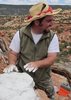
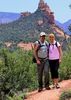
IMO, I could do without the pictures of the hikers, though - especially the blog author smiling in front of that. I totally get that commenter's POV.
IMO, I could do without the pictures of the hikers, though - especially the blog author smiling in front of that. I totally get that commenter's POV.
There are just two switchbacks left. And another half-mile to the destination...
contribute to this member driven resource
ie: RS > Save/Share after hikes
-
 azdesertfatherGuides: 16 | Official Routes: 21Triplogs Last: 5 d | RS: 18Water Reports 1Y: 2 | Last: 327 d
 - Joined: Apr 30 2008 9:57 am
- City, State: Tucson, AZ
- Contact:
Re: Schultz Fire on the San Francisco Peaks
Here's the latest burn map I could find, from 9 hours ago
http://www.knau.org/media/free_use_images/piomap.pdf
http://www.knau.org/media/free_use_images/piomap.pdf
"I went to the woods because I wished to live deliberately, to front only the essential facts of life, and see if I could not learn what it had to teach, and not, when I came to die, discover that I had not lived." — Henry David Thoreau
contribute to this member driven resource
ie: RS > Save/Share after hikes
-
 hippiepunkpirateGuides: 25 | Official Routes: 23Triplogs Last: 501 d | RS: 0Water Reports 1Y: 0 | Last: 3,873 d
 - Joined: May 30 2008 7:43 am
- City, State: Peoria, AZ
- Contact:
Re: Schultz Fire on the San Francisco Peaks
Based on my dad's pics from highway 89 around 3pm this afternoon, it looks like the fire has dropped into Lockett Meadow.
contribute to this member driven resource
ie: RS > Save/Share after hikes
-
PaleoRobGuides: 171 | Official Routes: 78Triplogs Last: 672 d | RS: 24Water Reports 1Y: 0 | Last: 1,059 d
- Joined: Apr 03 2006 12:21 pm
- City, State: Pocatello, ID
- Contact:
Re: Schultz Fire on the San Francisco Peaks
Wow, amazing pics from that blog. I don't see anything majorly wrong with posing in front of the smoke clouds - I'd probably do the same. A bit strange, but not callus in my opinion.
contribute to this member driven resource
ie: RS > Save/Share after hikes
-
 chumleyGuides: 94 | Official Routes: 239Triplogs Last: 5 d | RS: 73Water Reports 1Y: 95 | Last: 3 d
 - Joined: Sep 18 2002 8:59 am
- City, State: Tempe, AZ
Re: Schultz Fire on the San Francisco Peaks
The good news ... its now 20% contained and evacuated residents will be allowed back beginning tomorrow. The bad news, the stands of aspen it has encountered have "reduced fire behavior only to a minimal extent" according to this evening's report. The fire is also burning up to 10,500 feet, and it is in the steep and higher terrain (some of which is wilderness) where stopping the fire will be most difficult.
On a positive note, I've got to believe that the higher the elevation, the more moisture there is in the fuel. I mean, there's still snow in the Inner Basin!
If the winds stay down for a few days, hopefully they can get a better perimeter on this thing.
On a positive note, I've got to believe that the higher the elevation, the more moisture there is in the fuel. I mean, there's still snow in the Inner Basin!
If the winds stay down for a few days, hopefully they can get a better perimeter on this thing.
I'm not sure what my spirit animal is, but I'm confident it has rabies.
contribute to this member driven resource
ie: RS > Save/Share after hikes
-
paulhubbardGuides: 8 | Official Routes: 1Triplogs Last: 166 d | RS: 0Water Reports 1Y: 0 | Last: 4,399 d
- Joined: Jun 01 2010 9:54 am
- City, State: Mesa, AZ
- Contact:
Re: Schultz Fire on the San Francisco Peaks
If they could only find the idiot(s) who left their campfire unattended - oooh don't get me started on the kinds of punishment that they deserve... I grew up in Flagstaff, Schultz pass and the entire north side of the mountain was our playground. To see it destroyed due to carelessness is beyond words. I know it will rebuild itself, but it's still a horrible turn of events.
Good judgement comes from experience. Experience comes from bad judgement.
contribute to this member driven resource
ie: RS > Save/Share after hikes
-
PaleoRobGuides: 171 | Official Routes: 78Triplogs Last: 672 d | RS: 24Water Reports 1Y: 0 | Last: 1,059 d
- Joined: Apr 03 2006 12:21 pm
- City, State: Pocatello, ID
- Contact:
Re: Schultz Fire on the San Francisco Peaks
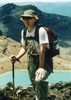
My two pictures are up on my Kin Bineola photoset, if anyone wants to see what the smoke was doing out here...
contribute to this member driven resource
ie: RS > Save/Share after hikes
-
 NighthikerGuides: 0 | Official Routes: 0Triplogs Last: 1,644 d | RS: 0Water Reports 1Y: 0 | Last: never
 - Joined: Feb 03 2002 6:59 am
- City, State: Payson
Re: Schultz Fire on the San Francisco Peaks
Spent the past couple of days in the White Mtns. On sunday observed the smoke plume at the Showlow airport. This one is going to hurt.
jk
contribute to this member driven resource
ie: RS > Save/Share after hikes
-
paulhubbardGuides: 8 | Official Routes: 1Triplogs Last: 166 d | RS: 0Water Reports 1Y: 0 | Last: 4,399 d
- Joined: Jun 01 2010 9:54 am
- City, State: Mesa, AZ
- Contact:
Re: Schultz Fire on the San Francisco Peaks
A Facebook friend said Lockett Meadow has burned. Is that true? If so that's extremely sad, the inner basin is (was?) such a beautiful spot...
Good judgement comes from experience. Experience comes from bad judgement.
contribute to this member driven resource
ie: RS > Save/Share after hikes
-
JimGuides: 76 | Official Routes: 39Triplogs Last: 33 d | RS: 93Water Reports 1Y: 6 | Last: 44 d
- Joined: Sep 08 2006 8:14 pm
Re: Schultz Fire on the San Francisco Peaks
That map is pretty nice, especially since the update and map the FS put on their website hasn't worked yet. Still, they didn't lay the fire boundary over a very good area map. You can't tell ridge tops or elevations at all. You can see from that now 12 hour old map that it clearly had burned up the east and south sides of Sugarloaf, and it needed it, but not into Lockett Meadow. Lockett is not the Inner Basin. I wouldn't get freaked out by Lockett burning, as they can use that area to produce a break to stop spread up the basin. After all, the area in and around Lockett, and for some distance up slope is mixed conifer and that area would have burned until suppression began. The large aspen groves and aspen mixed in there are a result of man. As far as burning over ridges and down into the Inner Basin, It could happen, but burning down slope in the aspen is completely different than burning upslope in dense decadent mixed conifer.
Snow is very high up in the basin. Also, ever notice the very open nature of the upper end of the Inner Basin south of the Core Ridge? Thats because there was a fire in that area about 100 years ago.
Snow is very high up in the basin. Also, ever notice the very open nature of the upper end of the Inner Basin south of the Core Ridge? Thats because there was a fire in that area about 100 years ago.
contribute to this member driven resource
ie: RS > Save/Share after hikes
-
hippiepunkpirateGuides: 25 | Official Routes: 23Triplogs Last: 501 d | RS: 0Water Reports 1Y: 0 | Last: 3,873 d
- Joined: May 30 2008 7:43 am
- City, State: Peoria, AZ
- Contact:
Re: Schultz Fire on the San Francisco Peaks
I read that 2/3 of Bonito Park burned near Sunset Crater.
contribute to this member driven resource
ie: RS > Save/Share after hikes
-
JimGuides: 76 | Official Routes: 39Triplogs Last: 33 d | RS: 93Water Reports 1Y: 6 | Last: 44 d
- Joined: Sep 08 2006 8:14 pm
Re: Schultz Fire on the San Francisco Peaks
After Reading the InciWeb update for the fire which states the Fire started at Schultz Tank and the (Little) Elden Trail, I went and looked at the trail and then my description of my triplog through that area last year. Here is yet another example of me talking about how they did not follow up with their burn plans. I mention the changing conditions of the forest and all that. Its a like beating a dead horse, but so much of that area was very easy to protect from this kind of event if they had just done a little bit of management. Really, if you want to have forests around towns and cities in this day and age, you have to manage them. To do that you have to fund them. This fire has cost nearly 2 million dollars. How much better could the forest have looked if that money had been spent on preventative forest management and not n expensive suppression cost like tankers, 900 firemen, bulldozers, etc, etc.
http://hikearizona.com/x.php?I=4&ZTN=360&UID=31493
http://www.fs.fed.us/r3/coconino/condit ... p-2010.jpg
http://hikearizona.com/x.php?I=4&ZTN=360&UID=31493
http://www.fs.fed.us/r3/coconino/condit ... p-2010.jpg
contribute to this member driven resource
ie: RS > Save/Share after hikes
-
JimGuides: 76 | Official Routes: 39Triplogs Last: 33 d | RS: 93Water Reports 1Y: 6 | Last: 44 d
- Joined: Sep 08 2006 8:14 pm
Re: Schultz Fire on the San Francisco Peaks
Good, it will freshen the range.hippiepunkpirate wrote:I read that 2/3 of Bonito Park burned near Sunset Crater.
Also,
Size: approximately 14,000 acres
Containment: 20%
Actions: Today crews focused on constructing line along the southern heel and southwest edge of the fire with the aid of helicopters, following the fire's edge directly when possible and going indirect as terrain and fire activity dictated. Line construction also continued on the northeastern edge of the fire with the use of dozers, hand crews and air tankers, which reinforced the line with retardant drops. Tonight crews may perform burnout operations on indirect portions of line as conditions allow.
Fire progression slowed today on the west side-closest to the San Francisco Peaks-due to the higher moisture levels of aspen stands in the area, and more moderate fire behavior was observed across the incident due to lighter winds. Crews scouted and began line construction on the western edge as line construction progresses from the south.
Most of the fire growth tonight is anticipated in Weatherford Canyon as terrain there lines up with predicted southern winds. However, only moderate activity is anticipated. Southeasterly winds may bring smoke into the valley tonight, so Flagstaff residents should prepare accordingly.
Power returned to Wupatki Estates this morning, and the eastern edge of the fire continues to hold well as firefighters patrol and mop up to further secure the line.
Best Map Yet:
https://inciweb.nwcg.gov/ftp/InciWeb/AZ ... 519-3.jpeg
contribute to this member driven resource
ie: RS > Save/Share after hikes
-
JimGuides: 76 | Official Routes: 39Triplogs Last: 33 d | RS: 93Water Reports 1Y: 6 | Last: 44 d
- Joined: Sep 08 2006 8:14 pm
Re: Schultz Fire on the San Francisco Peaks
You know, from looking at that map, and assuming it is accurate to the starting location of the fire, it did not actually start at the tank near the Little Elden Trail. According to the map it started from a campsite right on the lowest portion of the Water Line Road/ Trail. There are several dispersed campsites in that area.
contribute to this member driven resource
ie: RS > Save/Share after hikes