 Route Editor

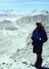
Wabayuma peak wilderness
Moderator: HAZ - Moderators
Linked Guides none
Linked Area, etc none
-
 tonybGuides: 0 | Official Routes: 0Triplogs Last: none | RS: 0Water Reports 1Y: 0 | Last: never
 - Joined: Nov 22 2002 6:03 am
- City, State: lou. ky
Wabayuma peak wilderness
I am interested in visiting this area in mid April-2003 for a couple nights. I have no desert hiking experience being from Ky, but have backpacked for many years in all areas around my home. My wife will be joining me on condition that I take her to Vegas for a couple days. Is this area a good pick for a couple rookies. Any info greatly appreciated.
contribute to this member driven resource
ie: RS > Save/Share after hikes 

-
 mtoomeyazGuides: 0 | Official Routes: 0Triplogs Last: 8,635 d | RS: 0Water Reports 1Y: 0 | Last: never
 - Joined: Apr 09 2002 7:08 am
- City, State: Gilbert, AZ
Hello tony b Sorry no one has responded to a new member for 2 days. That is unusual for this site. Unfortunately, I don't any specific info on this hike for you. Generally speaking, April should be a very pleasant time for desert hiking. As a rule of thumb, we always recommend carryingplenty of water in the desert. Hopefully the lack of responses is due to a weekend posting and everyone is out hiking! Stay tuned and someone should have some info for you and welcome to HAZ.
Mike T
-------------------------------------------------
Less is more
-------------------------------------------------
Less is more
contribute to this member driven resource
ie: RS > Save/Share after hikes
-
 azhiker96Guides: 0 | Official Routes: 0Triplogs Last: 1,181 d | RS: 2Water Reports 1Y: 0 | Last: never
 - Joined: Feb 03 2002 10:17 am
- City, State: Gilbert, AZ
Hi Tony, welcome to the site! This site has the best trail listing I've found anywhere. You can select a region of the state and then read the description of the trails listed. There are lots of great desert trails near Phoenix and if we get rain there could easily be tons of wildflowers. A good one near Phoenix is the Hiroglyphic trail. It starts in the desert and leads into a canyon on the edge of the Superstitions. You'll see lots of flora and maybe some wildlife as well. There's also a ton of petroglyphs. I'm sure there's hikes in NW Arizona closer to Lost Wages.  Post the area you're interested in and I'm sure this group will come up with 5 star suggestions.
contribute to this member driven resource
ie: RS > Save/Share after hikes
-
 LizardGuides: 15 | Official Routes: 0Triplogs Last: 5,506 d | RS: 0Water Reports 1Y: 0 | Last: never
 - Joined: Feb 05 2002 6:40 pm
- City, State: Phoenix, AZ
Well, the only book I was able to find info in was "Exploring Arizona's Wild Areas." This area may be a bit intense for hikers who are new to desert hiking. There are no trails, so you will be hiking cross-country. Also, water sources look fairly scarce and unreliable, especially given the drought, so if you do choose to hike here I would recommend carrying all the water you need (which can be *really* heavy). In addition, you should keep in mind that this is not a popular area, so if you do run into trouble you are not likely to have another hiker come along. You will be responsible for getting yourself out of the wilderness. Its fairly far from any cities and is not likely to have a cell phone signal.
Personally, I wouldn't hike here for your first desert hike. It may be better to choose an area that sees more people, like the Mazatzal or Superstition Wildernesses. If you do a search on this site you will find many hike suggestions for these wildernesses.
If you are insistent upon getting out to Western AZ and away from the crowds (which I understand totally), you might want to check out the Swansea Wilderness or the Rawhide Mountains Wilderness. These areas include the Bill Williams River, so at least your water problems will be taken care of.
Have fun,
Lizard
"Of course we weren't lost. We were merely where we shouldn't have been, without knowing exactly where that was."
contribute to this member driven resource
ie: RS > Save/Share after hikes
-
 joebartelsGuides: 264 | Official Routes: 224Triplogs Last: 2 d | RS: 2067Water Reports 1Y: 29 | Last: 1 d
 - Joined: Nov 20 1996 12:00 pm
That's getting pretty far out for the masses of urban dwellers here, but a couple photos recently came in nearby Waya...
http://hikearizona.com/photocodeZOOM.php?ID=484
http://hikearizona.com/photocodeZOOM.php?ID=484
- joe
contribute to this member driven resource
ie: RS > Save/Share after hikes