 Route Editor

This topic was started back on 2/27/02 after we drove up to Panguitch, Utah, and we lamented the dry conditions. We've eliminated the first post from 2/27/02 since it was mostly a narrative that's no longer relevant. We suggest you read this particular topic starting with the last post and then work your way backwards. The most current information and comments will be in the most recent post, which normally appears as the last post (unless you check that box that allows the last post to be viewed first). Got it?
J&S IN RR
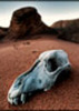
The Big Dry
Moderator: HAZ - Moderators
Linked Guides none
Linked Area, etc none
-
 montezumawellGuides: 6 | Official Routes: 0Triplogs Last: 7,712 d | RS: 0Water Reports 1Y: 0 | Last: never
 - Joined: Feb 03 2002 6:32 pm
- City, State: Montezumawell, AZ
The Big Dry
Last edited by montezumawell on Apr 28 2002 8:41 am, edited 2 times in total.
contribute to this member driven resource
ie: RS > Save/Share after hikes 

-
 joebartelsGuides: 264 | Official Routes: 224Triplogs Last: 5 d | RS: 2066Water Reports 1Y: 28 | Last: 18 d
 - Joined: Nov 20 1996 12:00 pm
contribute to this member driven resource
ie: RS > Save/Share after hikes
-
 FritzskiGuides: 43 | Official Routes: 0Triplogs Last: 3,458 d | RS: 0Water Reports 1Y: 0 | Last: never
 - Joined: Feb 04 2002 8:26 am
- City, State: Gilbert, AZ
contribute to this member driven resource
ie: RS > Save/Share after hikes
-
 BoyNhisDogGuides: 0 | Official Routes: 0Triplogs Last: none | RS: 0Water Reports 1Y: 0 | Last: never
 - Joined: Feb 03 2002 2:09 pm
- City, State: Tucson, AZ
contribute to this member driven resource
ie: RS > Save/Share after hikes
-
montezumawellGuides: 6 | Official Routes: 0Triplogs Last: 7,712 d | RS: 0Water Reports 1Y: 0 | Last: never
- Joined: Feb 03 2002 6:32 pm
- City, State: Montezumawell, AZ
Not looking good!
On March 11, we received the March 1 'Arizona Basin Outlook Report' from the US NRCS. It calls the snowpack readings 'dismal,' a word not ordinarily found in gov't reports. Runoff in the major streams will range from 13-27% of median. In the report's front page 'Looking Ahead' section, we found the following (re-typed here verbatim):
'Drought has surfaced in Arizona. Abnormal dryness has developed and precipitation for the past 5 months has been under 50% of normal for the region.'
'Given the forecast tendency for dry and warm weather to prevail over the next several months, the NOAA's Climate Prediction Center expects a strong possibility that drought will extend across the entire state by May.'
'Above normal snowfall is needed to provide adequate water supplies next year. It will take several wet winters to recharge the soil and fill Arizona's reservoirs.'
The report is signed by the State Conservationist, Mike Somerville.
J&S in RR
contribute to this member driven resource
ie: RS > Save/Share after hikes
-
montezumawellGuides: 6 | Official Routes: 0Triplogs Last: 7,712 d | RS: 0Water Reports 1Y: 0 | Last: never
- Joined: Feb 03 2002 6:32 pm
- City, State: Montezumawell, AZ
Another road trip report
Well, here we are again heading up into Utah. You might want to know there was very little snow alongside the I-state on the way to Flagstaff. It's the kind of snow which doesn't produce runoff and hardly swets the soil an inch or two. Still dry as a bleached bone. There's a dusting on the Peaks so the photographers don't get shut out this winter. Snow on the North Rim along Hwy 89A looked like less than was there on 2/27. We couldn't see any snow on Yovimpa Popint in Bryce. Just some on Brian Head--real high places like that. Kanab is T-shirt weather. More when we see it.
J&S in RR
J&S in RR
contribute to this member driven resource
ie: RS > Save/Share after hikes
-
 nealzGuides: 4 | Official Routes: 0Triplogs Last: 8,765 d | RS: 0Water Reports 1Y: 0 | Last: never
 - Joined: Feb 10 2002 2:20 pm
- City, State: Alpine, AZ
I was just talking to a couple Forest Service folks about conditions in the Mazatzals today. Their spin on the dry conditions is that right now, they may not open large areas of many Arizona NF's at all this summer. :!: Although the lack of rain has put the kibosh on desert wildflowers this spring (bad thing) it also means there isn't a lot of dried up weed fuel for desert grassfires later (good thing). However, the heavy timber high country needs the reserve of winter rain and snow to stay relatively moist until the monsoon starts in late summer. I hope for all of our sakes it starts to rain soon. Start doin' those rain dances folks.
-Nealz
-Nealz
contribute to this member driven resource
ie: RS > Save/Share after hikes
-
montezumawellGuides: 6 | Official Routes: 0Triplogs Last: 7,712 d | RS: 0Water Reports 1Y: 0 | Last: never
- Joined: Feb 03 2002 6:32 pm
- City, State: Montezumawell, AZ
Better review your "summer" hiking plans
Thanks, Nealz, for posting about that kind of speculation. We were reviewing the US NRCS March 15th snowpack and runoff report today and the figures are particularly bleak. Our first thought wasm 'wow, the forests might not even open up.' Lo aand behold, you already posted on that thought. The mid-March snowpack totals and the projected runoff through May are as bleak as we've seen 'em in a LOOOONG time.
Here's the nitty-gritty:
Percentage of 30-year Average Snowpack Levels as of March 15
Verde River 4%
Little Colorado River Basin 11%
Central Mogollon Rim 5%
Grand Canyon 13%
Salt River Basin 18%
S.F. Peaks 19%
The statewide average is 15%.
Even bleaker are some of the projected stream runoff figures:
Salt River 9%
Tonto Creek 6%
Little Colorado 4%
Basically, the key numbers here are the Verde Basin and the Central Mogollon Rim snowpack figures of 4 and 5 percent respectively. These numbers give a good interpolated look at dryness near Sedona, around Prescott and in the Bradshaws and all throughout the Payson & Tonto Basins.
Barring additional significant moisture, it would seem improbable that the Forests would be open when prime tourist season breaks loose around Memorial Day. Although Arizona's fickle, unpredictable climate can produce dramatic flip-flops, it's not necessarily the 'way to bet.'
Consequently, if you are planning to hike in the pine trees or along one of those spiffy little creeks that drain from Rim Country, you probably ought to move UP your hiking dates and try to beat feet for your favorite high country trail(s) ASAP! After all the fire disasters of recent years, we somehow think the Forest Service will error on the side of extreme caution this year.
J&S in RR
contribute to this member driven resource
ie: RS > Save/Share after hikes
-
BoyNhisDogGuides: 0 | Official Routes: 0Triplogs Last: none | RS: 0Water Reports 1Y: 0 | Last: never
- Joined: Feb 03 2002 2:09 pm
- City, State: Tucson, AZ
As dry as things are, life still finds a way. I found this today down by the Rillito River.
Desert Marigolds in the Drought
Desert Marigolds in the Drought
Glen
contribute to this member driven resource
ie: RS > Save/Share after hikes
-
montezumawellGuides: 6 | Official Routes: 0Triplogs Last: 7,712 d | RS: 0Water Reports 1Y: 0 | Last: never
- Joined: Feb 03 2002 6:32 pm
- City, State: Montezumawell, AZ
We are not alone
At times like these, perhaps it helps a little to know that the drought is strangling a huge area of the Western US. Below are two really great links to help you better understand the extent of and forecasts for the current drought.
This first link is to the Climate Prediction Center. They released today (April 18) their latest drought forecast and it really doesn't look good for AZ. Check it out at:
http://www.cpc.ncep.noaa.gov/products/e ... ought.html
The next link is for a page of various drought related links. Lots of good maps if you follow the links on this page:
http://www.nws.noaa.gov/oh/hic/current/ ... index.html
You will note the Pacific Northwest, especially the Olympic National Park, is rated as 'extremely wet.' Can you imagine what those trails through the rain forests will look like in early summer? Hummm..... :P
J&S in RR
contribute to this member driven resource
ie: RS > Save/Share after hikes
-
FritzskiGuides: 43 | Official Routes: 0Triplogs Last: 3,458 d | RS: 0Water Reports 1Y: 0 | Last: never
- Joined: Feb 04 2002 8:26 am
- City, State: Gilbert, AZ
contribute to this member driven resource
ie: RS > Save/Share after hikes
-
 evenstarx3Guides: 1 | Official Routes: 0Triplogs Last: 8,563 d | RS: 0Water Reports 1Y: 0 | Last: never
 - Joined: Feb 03 2002 8:44 am
- City, State: Sun City West, AZ from CA
Spent Thursday and yesterday at an RV resort in Camp Verde, sprinkled very lightly both evenings; that was all. Hiked Boynton Canyon Thursday afternoon; I'm sure that creek should have been running pretty well this time of year, but it was bone dry. Not even damp creekbed anywhere.
Hooli, aka Trihairopelli
"They say the dog is man's best friend.
I don't believe that. How many of your friends have you neutered?"
--Larry Reeb
"They say the dog is man's best friend.
I don't believe that. How many of your friends have you neutered?"
--Larry Reeb
contribute to this member driven resource
ie: RS > Save/Share after hikes
-
montezumawellGuides: 6 | Official Routes: 0Triplogs Last: 7,712 d | RS: 0Water Reports 1Y: 0 | Last: never
- Joined: Feb 03 2002 6:32 pm
- City, State: Montezumawell, AZ
Coming off fast
The April 28th Republic carried a drought story initially published in the Chicago Tribune of all places. In passing, it noted that the Rio Grande snowpack was 38% on the first of April but only 9% in late April, presumably last week sometime before the story was written. Most of you know the Rio Grande's headwaters are in Wolf Creek Pass NE of Pagosa Springs and that the pass is also the San Juan River's headwaters as well. This little tidbit of info about the snowpack's Warp 9 rapid disappearance can be pretty well applied to most of the southern and central Intermountain West. It also infers a very significant 'dry out' scenario for other areas, such as Arizona, that long ago lost their pseudo-snowpack. Those 'banshee' style winds late last week also tend to accelerate the 'dry out' trend.
Perhaps Joe could have a contest for all of us to 'pick the forest closure date.' Barring a 'freak storm,' we're going to place our bets on May 15. This would give the USFS publicists time to get the news out to the metroplex media on the weekend before Memorial Day and would give the USFS field crews time to lock the various gates and get the various required signage in place before the holiday weekend, as well as scheduling manned roadblocks and the necessary enforcement patrols.
We don't really know what their parameters are to close the forest but it has a lot to do with fuel moisture levels and those moisture levels are already getting as close to zero as they can get. Can you imagine how a rimlands fire would have behaved in those wild winds of last week? You can bet that topic is 'hot' on the minds of fire managers everywhere. Time will tell. What are your thoughts?
J&S in RR
contribute to this member driven resource
ie: RS > Save/Share after hikes