| | -
-
-
| |  |
|
1 |
-
-
-
-
-
-
| |  |
|
2 |
-
-
-
|
| | |
|
| Hiking | 2.60 Miles |
|
| | Hiking | 2.60 Miles | 1 Hour | | 2.60 mph |
| | | |
| |
| Linked |
|
none
[ show ]
| no linked trail guides |
| Partners |
|
none
[ show ]
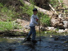
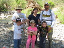
| no partners | | | Took the family out for a kiddie hike. The trails in this area seem to form a figure-8 loop according to the only map available from Maricopa County. This area seems to be independently managed from the county. The entire system is probably in the 2-3 mile range, but we only did about a mile due to the kids being present and much more focused on playing in the creek rather than hiking. Fortunately didn't see any rattlesnakes, which was a concern with toddlers running around. The northernmost crossing was the trickiest, but that also made it the most fun for the kids to negotiate their way across the trail of rocks over the creek. Naturally, we stopped at Harold's for lunch on the way back to continue the indoctrination of my kids. |
| _____________________
| | |
|
|
|
|
|
| |
