| | -
-
| 1 label |  |
|
|
-
| 1 label |  |
|
|
-
-
-
| 1 label |  |
|
|
-
-
-
-
-
| 2 labels |  |
|
|
-
-
-
| 1 label |  |
|
|
-
|
| | |
|
| Hiking | 8.54 Miles |
1,028 AEG |
| | Hiking | 8.54 Miles | 3 Hrs 10 Mns | | 2.70 mph |
| 1,028 ft AEG | | | | |
|
|
| |
| Partners |
|
none
[ show ]
| no partners | | It’s a long drive from Sunnyslope to Queen Creek, so it’s been three years since I last hiked here. I was hoping to at last find some of the brittlebush, creosote and African daisy currently blooming in the Phoenix Mountain Preserve. I hiked Dynamite, San Tan, Moonlight and Goldmine counter-clockwise from the still under construction Goldmine TH.
Dynamite is rated moderate, but the elevation gain is barely noticeable. No more than slightly rocky, in spots. The few saguaro are young, and I saw no flowers. Nice views from the Sparks bench.
San Tan is somehow rated “moderate-difficult”. Maybe that is for mountain bikes at the south end of the park? I dunno. At the north end, it is wide, smooth and fast. Also popular. As are all the trails in the middle of the park. Though it loops around most of the park, I was only on it for a mile.
Moonlight Trail is rated moderate. Really, though, it is easy: West-to-east, Moonlight rises only 130 ft. in 1⅓ miles, ending at the welcome center. Heading west, it would be a zippy mountain bike ride. Still no flowers, but I did enjoy the saguaro.
I was wearing my Camelbak, but feeling a bit parched, so I stopped in the welcome center for a Gatorade and a water. I chugged the Gatorade before I even made it to the cash register. 
Goldmine is rated difficult and “hazardous” — which is fair for its middle third. The mile from the welcome center to San Tan Trail is a wide, smooth and zippy downhill mountain bike run. So, keep your head on a swivel. North of San Tan, Goldmine is steep & broken. Not bad hiking, but I sure would not ride it!
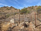
There’s two saddles, both with benches. At the second, more northerly bench, there are several informal trails. The one to the north is a steep little climb to a small hilltop outlook. I elected to save it for a future hike.
Descending north from the second bench is where I believe Goldmine gets its rating: The initial 1/10 mile drops a whopping 170 ft. And it is slippery. After that initial drop, Goldmine "levelsout" out at 400 ft. in the next 1/2 mile.
I arrived back at Goldmine TH about 12:30 p.m. The temp was 75℉, but it felt warmer. Supposed to be in the 90s next week! 
~~~~~~
Crud! Didn't mean to click post ... |
|
Wildflowers Observation None
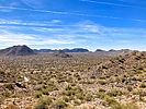
The rest of the Valley is at least showing brittlebush, creosote and African daisy. Here? Nada. Not a single bloom.  |
|
| _____________________
| http://prestonm.com : Everyone's enjoyment of the outdoors is different and should be equally honored. |
| | |
|
|
|
|
|
| |
