| | -
-
-
-
-
-
-
-
| 2 labels | 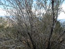 |
|
8 |
-
| 1 label | 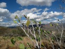 |
|
2 |
|
| | |
|
| Hiking | 8.33 Miles |
3,235 AEG |
| | Hiking | 8.33 Miles | 6 Hrs 55 Mns | | 1.77 mph |
| 3,235 ft AEG | 2 Hrs 12 Mns Break | 12 LBS Pack | | |
|
|
| |
| Linked |
|
none
[ show ]
| no linked trail guides |
| Partners |
|
[ show ]
| partners | | Another great Chris hike. This was the flip side to our July 10th hike for the upper section.
[ The Moody Connection ]
Crossing Cherry creek was easy as the flow is very minimal at five feet wide and a half foot deep. Finding the trail up was a task. Once on the path of cairns it wasn't too bad. Of course we had the advantage of combining Steve and Ken's previously posted tracks. Overall the weather was pretty nice throughout. There were some nice big fluffy Fraleys in check too.
We connected to our turn around point from July then headed back to the Bull junction for lunch. On the return we dropped off the side of the cliff and approached the ruins from above. It's not terribly steep from the top to the ruins. From the ruins down to the trail is pretty darn steep for about ten minutes.
Autumn gets a "light" rating for the small Arizona walnut trees starting to turn at the ruins. The drive in/out on the other hand is extreme through large portions of Cherry Creek. Outstanding multi hued orange and yellows on the sycamores!
Thanks everyone for a great hike!
[ youtube video ] |
|
Autumn Foliage Observation Light
|
|
| _____________________
| | |
|
|
|
|
|
| |
 Route Editor


