| | -
| |  |
|
1 |
-
-
-
-
| 1 label | 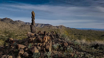 |
|
|
-
-
-
|
| | |
|
| Hiking | 5.20 Miles |
633 AEG |
| | Hiking | 5.20 Miles | 2 Hrs 45 Mns | | 2.69 mph |
| 633 ft AEG | 49 Mns Break | 7 LBS Pack | | |
|
|
| |
| Partners |
|
[ show ]
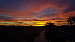
| partners | | | I wanted to do a hike out in Verrado since one of my harem members lives there and is always driving super far to meet the rest of us for hikes every weekend. Saw the petroglyphs attraction there off Lost Creek trail, spotted some obvious mountain bike trails on the satellite view, and put a nice 5 mile loop together. We were rewarded with seasonally warm temps in the 40's to start our hike from the Lost Creek trailhead. While not well marked, the trails were easy to follow. Razorwire topped chainlink fence surrounds the petroglyph site, I imagine to keep the graffiti artists at bay, which is disappointing since it doesn't appear to be real effective. We picked up the SOB (South Of the Border) trail heading south right from the Petroglyph site. SOB trail was pleasant, easy to follow, sort of signed, and meandered all the way back to where we split off Lost Creek trail to the Petroglyphs. Stopped at Verrado Coffee afterward which was great way to finish the morning. |
|
Wildflowers Observation Light
|
|
| _____________________
| | |
|
|
|
|
|
| |
 Route Editor


